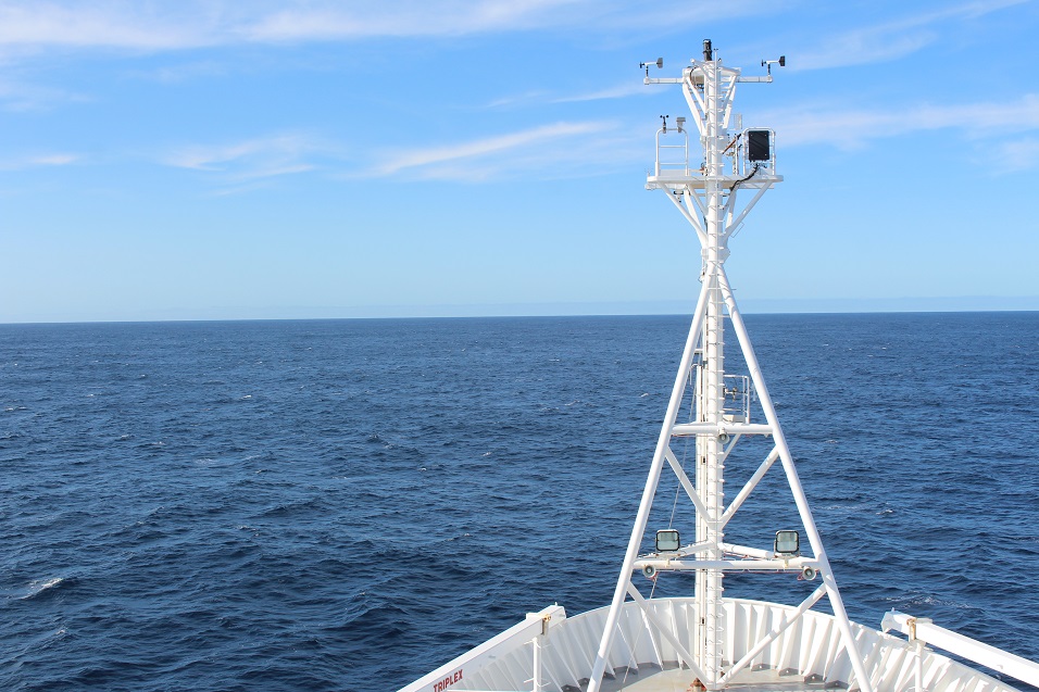
An IMAS-led voyage on the Marine National Facility research vessel Investigator today sailed from Hobart with scientists aiming to solve a Southern Ocean puzzle with important ramifications for the global climate.
The researchers will survey a ‘standing meander’ south of Tasmania that they hope will help them to understand why the east-flowing Antarctic Circumpolar Current (ACC) has remained constant despite westerly winds strengthening by 20% over the last two decades.
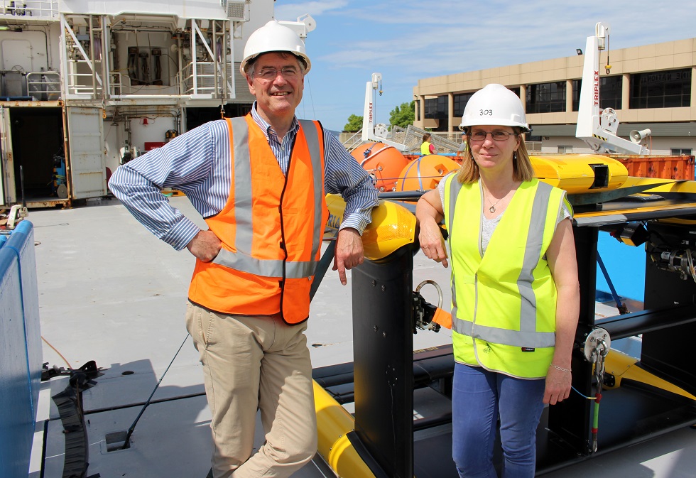
IMAS researcher Dr Helen Phillips (pictured below, right) said recent studies have pointed to the crucial role standing meanders play in influencing the speed of the current, making the ACC less sensitive to rising tailwinds.
“A standing meander is where the current changes direction abruptly in response to the topography of the seafloor, just as a river snakes its way among hills or mountains,” Dr Philips said.
 “Standing meanders occur only at a handful of sites around the world, where the current encounters rough seafloor topography. One of those sites is almost due south of Tasmania.
“Models indicate that the speed of the Antarctic Circumpolar Current is reduced sharply by standing meanders, rather than continuously along its full course.
“By collecting data and surveying the standing meander south of Tasmania we’ll be able to create a unique 3-dimensional picture of one of these intriguing features, improving our understanding of them and informing future models of the ACC and its influence on the global climate,” Dr Phillips said.
Voyage Chief Scientist Professor Nathan Bindoff (pictured above, left) said the ACC plays a central role in driving the global climate and will be a key factor in how the climate changes due to rising levels of atmospheric CO2.
“The current consists of eastward flowing jets, standing meanders and eddies that enable a global-scale overturning circulation that has allowed enhanced uptake of heat by the ocean,” Professor Bindoff said.
“Amazingly, the oceans absorb 93% of excess heat in the earth system, of which 65% is taken up in the Southern Ocean, and around 26% of anthropogenic CO2 emissions.
“If we are to better understand and predict how the climate will respond to anthropogenic carbon emissions we need to better understand key drivers of the ACC and Southern Ocean, including standing meanders.
“Standing meanders are hotspots for heat uptake and there are three major ones in the Southern Ocean.
“We are studying the simplest one so it is an ideal laboratory,” Professor Bindoff said.
The month-long voyage ends on 16 November and includes scientists from IMAS, CSIRO, ACE CRC, and universities across Australia, the US and New Zealand.
This is actually the first blog I have ever written and with the increasing social media pressure it probably won’t be my last, so bear with me.
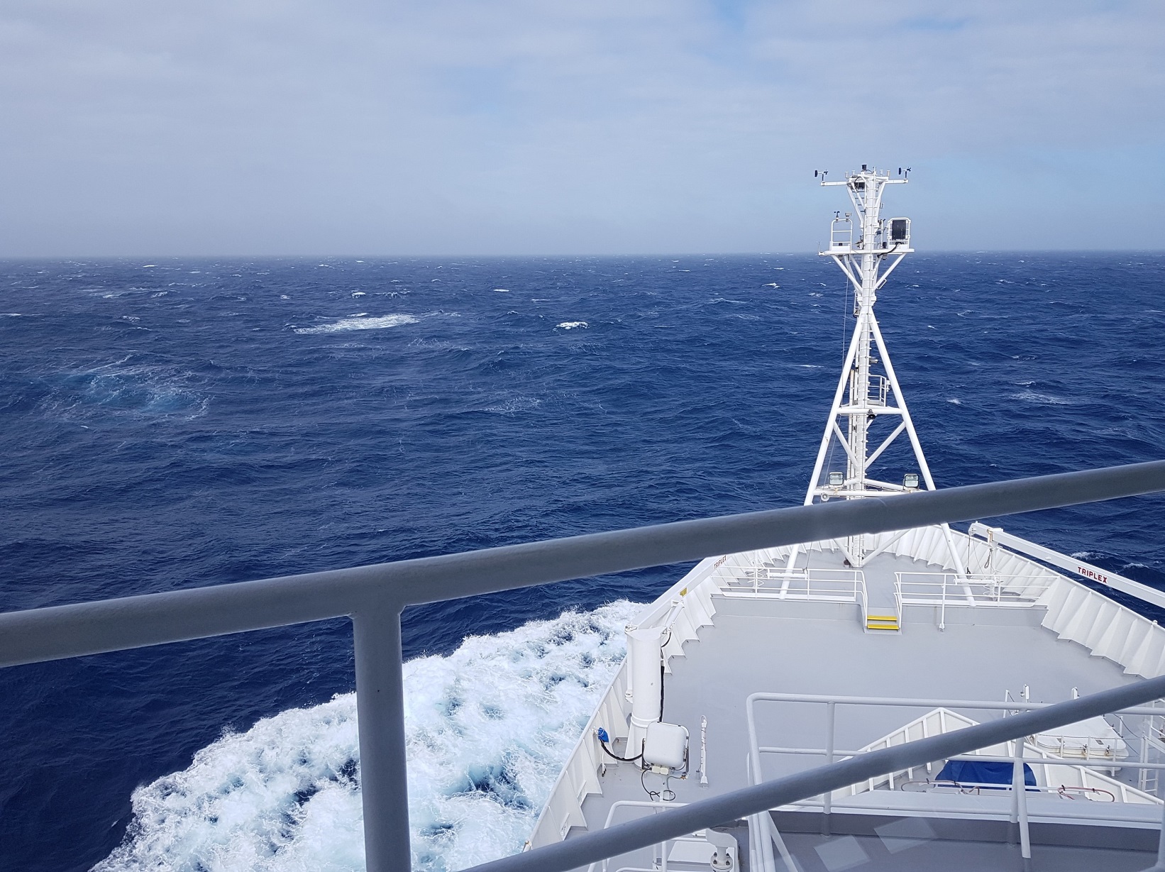
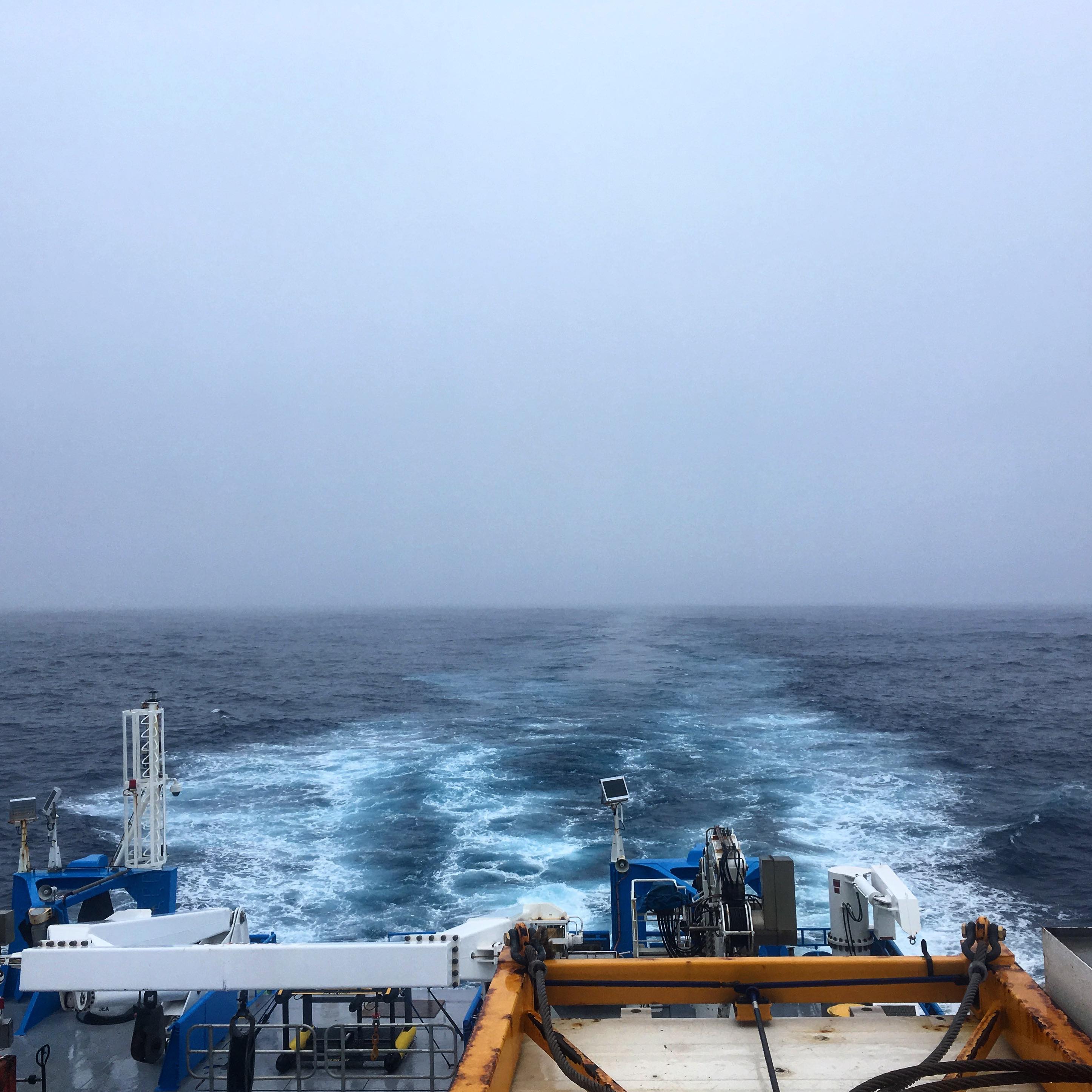
Exactly 31 days from today, we started this adventure from Hobart, Tasmania to explore some unknown territory at the end of the world. We steamed from 43 to 56 degrees latitude down south, where we found the current that we were looking for, the Polar Front. The Polar Front is part of a much larger global scale current that encircles Antarctica. In this area, we will be looking at how the current passes over rough topography and creates a meander similar to a meandering river.
 After 3 days of steaming, we arrived at the mooring location (see figure, left), where we deployed a 4000 metre depth mooring. Along the mooring line from the bottom to the surface a spread of current meters, temperature and conductivity sensors (from which we derive the salt content in the water) will measure how the temperature, salinity and water velocities change over depth and over the lifetime of the mooring (approximately 2 years).
Two days after deploying the mooring we started with a series of transects crossing the Polar front current from south to north just downstream from where the current flows over an underwater mountain ridge. Each transect consisted of multiple way points where an instrument, called a CTD was dropped down to just above the sea floor. By crossing the current and making several transects downstream, we can estimate how the temperature and salt content, which determine the density of the water varies across and along the meander. This is important for estimating how warm water can be transported across the front, and potentially melt the Antarctic ice sheet.
Every CTD cast takes about 3 hours, roughly 1 hour to reach the bottom and then 2 hours to come up again, like a yo-yo. We watch the data come in on several computer screens, and look for any misbehaving sensors. On the way up, we have to close 36 bottles that take water samples at different depths. These are attached to the CTD frame. Once the CTD is on board, we take these water samples from the bottles to determine oxygen, salinity and nutrient levels. The sampling undergoes a thorough procedure of cleaning and making sure that the water does not get contaminated.
After each CTD, an instrument called a VMP then goes into the water. This instrument is supposed to freefall in the water and makes measurements of turbulence, temperature and salinity, but on a much finer scale than the CTD.
During the first transect we also deployed 6 EM-APEX floats, these floats go down to 1600 meters depth while flowing with the current. From each dive we can derive temperature, salinity and velocities at different depth levels. When reaching the final depth an internal bladder is inflated, which increases their buoyancy bringing them back to the surface. When they reach the surface, the collected data is transmitted via satellite communication to shore. While the CTD transects give us high resolution observations in the cross-stream direction, the EM-APEX floats give us high resolution observations in the along stream direction. Ideally, we acquire a high resolution field in both directions. Because these floats are often deployed in rough seas sometimes instruments get lost. And so, for 2 of the 6 floats we deployed, we unfortunately lost communication just after deployment.
You probably think by now, what else can you throw in the water. Well, we have used another instrument called the TRIAXUS, which we tow behind the ship. Although it has three degrees of freedom, rolling, yawing and pitching, we only used the pitching part, which let the TRIAXUS go from the surface to a depth of about 300 meters in a sawing motion. Between the CTD transects we used the TRIAXUS to make diagonal transects and obtain very high resolution observations of temperature and salinty measurements of the upper water layer.
As a cherry on the cake, attached to the ship there are a few more instruments, such as the Multibeam and SADCP, which give us a detailed map of the seafloor depth and velocities up to about 600 metres in depth.
However, after 6000km of surveying, together with 77 CTDs, 56 VMPs and 8 TRIAXUS transects, it is time to finish this story and go home.
Unfortunately, aside from the 2 EM-APEX floats we will also not bring home our beloved VMP, since the VMP was lost in challenging conditions during one of its last planned deployments but,as they say: “if you are not prepared to lose an instrument, then do not put it in the ocean”.
It is a rough and risky environment and from this voyage I learned how valuable ocean observations are and how much effort and precision is needed to acquire them. The next two years I will continue working on this dataset as part of my PhD, and I can only hope for many more voyages to come, but for now I say from the research vessel Investigator, OVER and OUT!
 I am currently enrolled as a PhD student at Monash University in Melbourne, Australia. My research is to understand air-sea interaction through exchanges of momentum, heat and water vapour in the Southern Ocean. I have worked on a few field projects related to my research previously and was glad to be a part of another field voyage once again.
Since I have never worked in marine biology before, I took this opportunity to learn something new and decided to volunteer with the biogeochemical team in understanding biogeochemical cycles in the Southern Ocean along with phytoplankton.
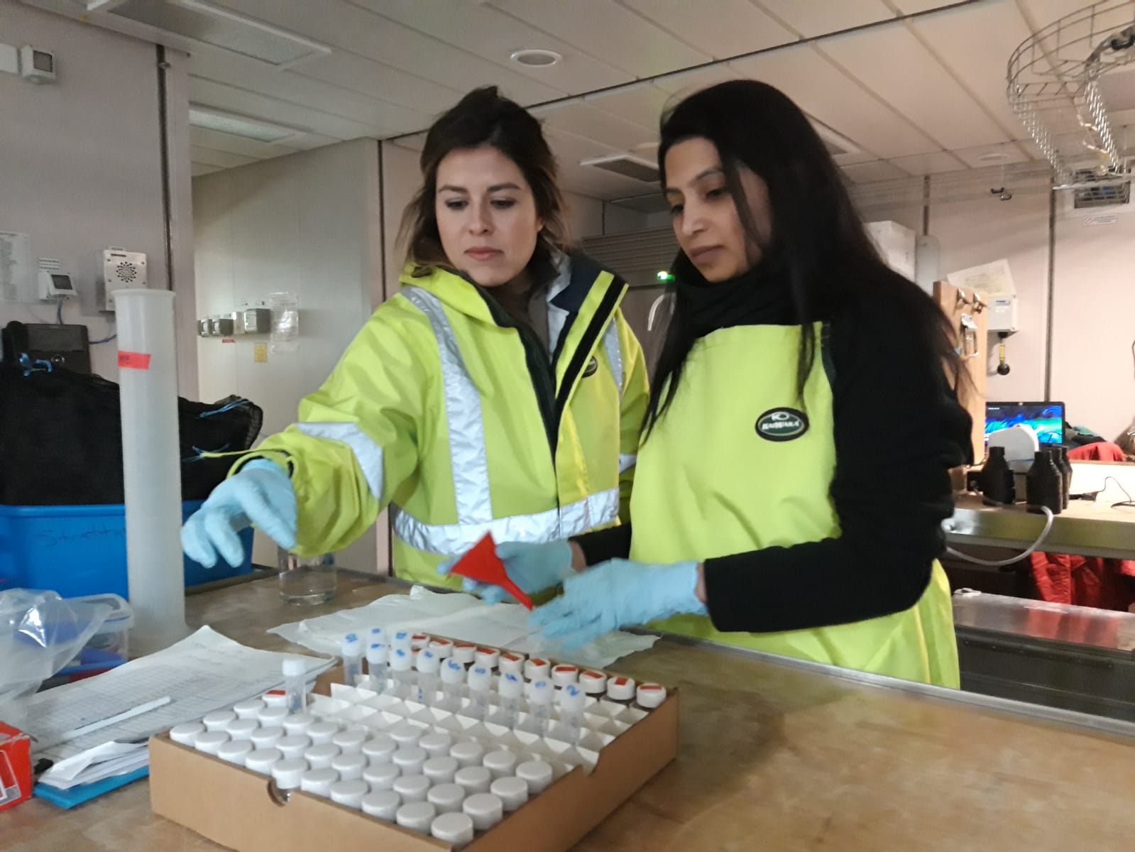 While onboard I, along with my teammate, Clara Rodrigues-Vives (IMAS), perform a wide variety of tasks related to our experiments like collecting and examining deep ocean water samples and conducting an incubation experiment to study phytoplankton growth and response to light. While I enjoy working in the lab, being on the ship with people from different countries is a unique experience.
In the middle of this ocean, I realise how big and beautiful our planet is. Although, it also strikes me how we, as a species, are polluting the oceans, and wiping out the marine life. It makes me care more about nature and wonder if sustainable solutions are possible in the near future.
We get to see the beautiful aurora australis from time to time and glimpse the Milky Way when the sky is clear, which is usually rare. I like going on the deck and meditating to the relaxing sound of ocean waves. However, standing still for few minutes in -10-degrees wind chill on the moving ship is quite a challenge.
It’s the final countdown. We’re only a few days away from being back on solid ground—it feels like we’ve been here an eternity but also only a few days. Out here in the open sea, time passes us by and the days blur together, punctuated by variations in the lunch menu for the day. The time remaining for more science is rapidly coming to an end.
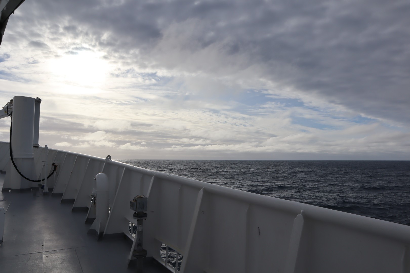
The Southern Ocean is known for its rough seas, but it has fortunately been relatively kind to us. While the skies have often been grey, the outside temperatures are cold (the current air temperature is 2.8°C but it feels like -16°C with wind chill), and we rock and roll around, we’ve been able to do most science without too much obstruction from the weather.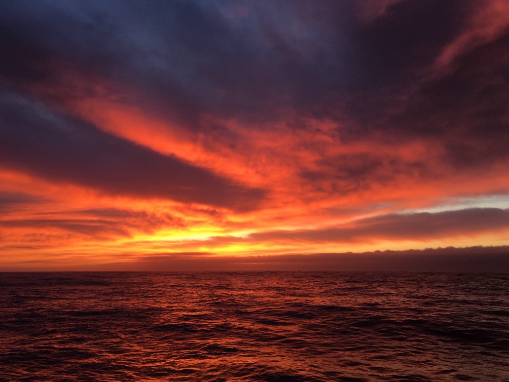
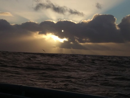
Every now and then, we are greeted by a spectacular sunrise - an event I would never be awake for when on land - filled with colours so vibrant that it almost seems fake (Pictured, right). This isn’t my first research voyage, or even my first time on this ship, yet witnessing the sunrise across the immense ocean landscape still feels a little surreal.
Soon we’ll begin our journey back to Hobart, after which we will all go our separate ways. We will recover from the exhaustion and hopefully curb our addictions to daily hot chocolates and delicious morning tea snacks. Some will continue working with the data that we’ve been collecting for a while yet. For me, I’ll return to my research in palaeoclimate, armed with a better understanding of oceanography and the Antarctic Circumpolar Current.
We’ve had many laughs together, but reality awaits.
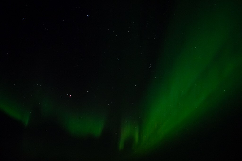 The phone rings in the operations room, “there’s a roaring Aurora starting up!” The five of us sitting in the operations room watching the CTD make its way to the ocean floor look at each other. Two stay. The rest of us join the throng hurrying up the seemingly endless stairs to the bridge. The view from the bridge’s large windows is worth the climb (Pictured, right. Credit: Sarah Lanier).
Despite growing up in Hobart, I had not seen an Aurora before this trip. Solar wind emitted by the sun interacts with the Earth’s magnetic field to cause charged particles to release energy in the upper atmosphere and produce the Southern Lights (and their counterpart in the northern hemisphere). We have seen the Aurora range from a ghostly pale glow to long filaments of green light, and on one memorable occasion, it has been tinged pink with dancing lights running up and down the green lines.
 We now have one week left of our Southern Ocean voyage, and we are settled into the routine of sampling the ocean, but Auroras, sunsets, the occasional penguin, or simply watching the swell go by break the routine up and help make this trip memorable.
This ocean voyage is also a first for me. I am not an oceanographer, but focus my studies on the atmosphere instead. This voyage is a great opportunity to experience how observations are taken, learn a bit about the Southern Ocean, and to see a part of the world otherwise out of my reach. Back on land, I look at monthly and seasonal maximum temperatures across Australia to try to find a connection to the Indian Ocean that could help us predict whether it will be unusually hot. On the ship, I look at satellite images and computer model predictions of the atmosphere to get an idea of the upcoming weather, wind and sea conditions, and to keep track of the systems that affect us. So far, we have been quite lucky with the worst of the weather crossing to the north of us, and relatively mild (though still quite bumpy at times) conditions here. Most of the time, however, I am simply asked, “will the skies be clear enough for us to see the Aurora tonight?”
I am a physical oceanography PhD student at IMAS-UTAS. In my PhD, I am studying internal waves and mixing in the southeast Indian Ocean. Internal waves are waves generated inside the ocean similar to those that we see at the ocean surface. When these waves break they result in turbulent mixing of water masses, which is important for transporting materials and energy across ocean basins.
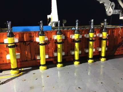 I am interested in the spatial and temporal variability of this small-scale (in the order of centimetres) turbulent mixing and how it impacts the large-scale circulation in the southeast Indian Ocean and subsequently climate. In my study, I use data from Electromagnetic Autonomous Profiling Explorer (EM-APEX) floats. These floats (pictured, right, photo credit: Ram Patel) provide comparatively inexpensive high-resolution measurements of horizontal velocity (3 – 4m in the vertical) in addition to the standard temperature, salinity and pressure measurements. They measure ocean velocity by measuring the electric current generated due to the movement of ocean water across the magnetic field of the earth.
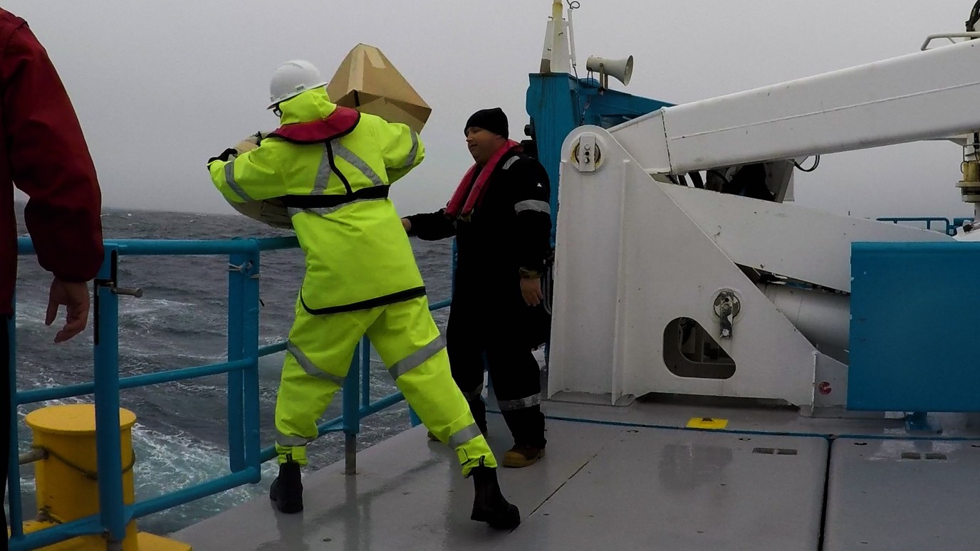
 In this voyage, my job is to collect water samples from the CTD rosette bottles. These water samples help to calibrate the CTD sensors. I have also assisted in deploying two of the EM-APEX floats (Fig.1). We deployed them along with the cardboard boxes they came in, which are biodegradable. We deployed 6 EM-APEX floats in this voyage in pairs along the polar front on our second CTD transect. Four of them are active and continue to profile as they follow the dynamic height contours. The floats have a lifespan of about 3 - 4 months depending on the battery and will continue to take measurements over this time.
Being on the AM shift (2am - 2pm) gives me the opportunity to see some magnificient sunrises (pictured). Sometimes I assist in deploying the VMP during which I also admire the albatrosses showing off their incredible gliding abilities.
Even though I get seasick very often, I am enjoying this voyage in terms of the science that we are undertaking. I have been on another research voyage before. However, this voyage showed me the risks that an observational oceanographer takes to get real ocean data. A few times we have had to cancel the measurements due to adverse weather conditions.
I am doing my PhD at the Institute for Marine and Antarctic Studies, University of Tasmania (IMAS, UTAS). I chose IMAS because of its diverse and advanced scientific culture with some of the world’s best leading scientists in my field of research. I am working with Prof. Nathan Bindoff and Dr. Helen Phillips from IMAS, and Dr. Ming Feng from CSIRO, WA.
 My PhD. project is about the estimation of ocean temperature and salinity variability due to anthropogenic climate change. Our research shows the Indian Ocean is the most affected basin due to climate change and its rate of warming is very high as compared to the Pacific and Atlantic Oceans.
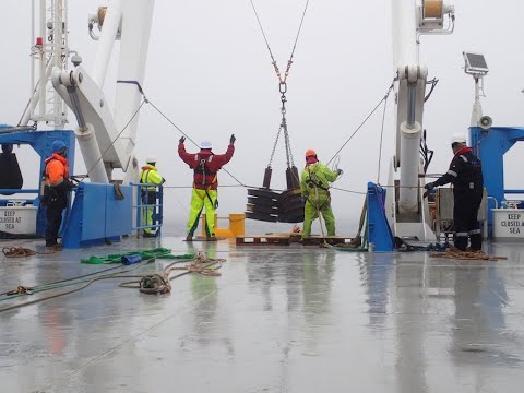
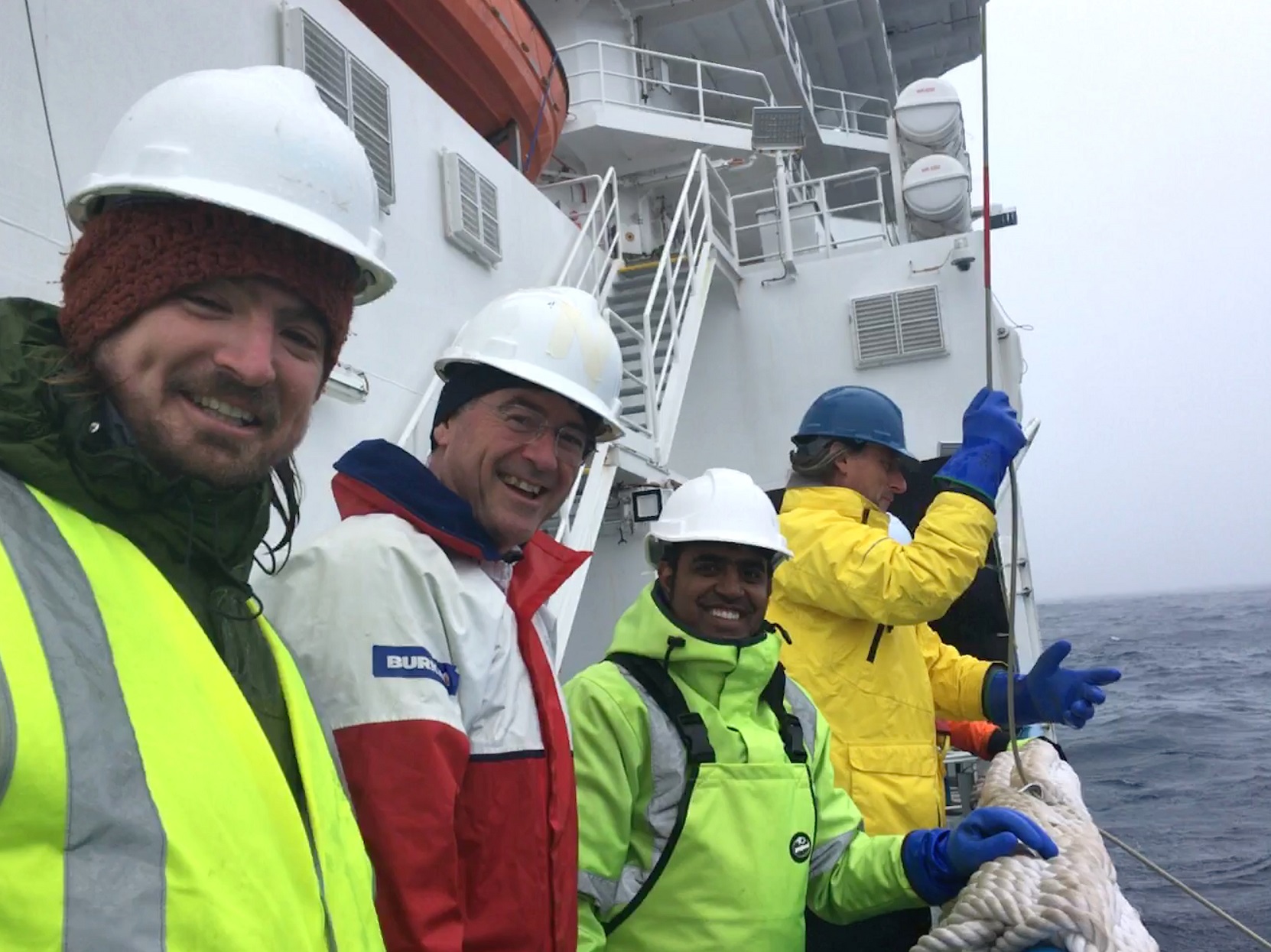
(Image, right,: Deploying VMP instrument into ocean with my team, L-R: Bryan Kaiser, Prof. Nathan Bindoff, Saurabh (me) and Dr. Kurt Polzin holding rope for VMP instrument. Photo credit: Nicky Wright)
All the world’s ocean heat from 2005-2015 is stored in the Southern Ocean in its upper 700m and contentiously is rising. In the next part of my PhD we are trying to use changes in ocean salinity for Australian rainfall estimation, which has not been extensively used previously.
Our initial results show, during extreme climatic events such as El-Niño Southern Oscillation (ENSO) and Indian Ocean Dipole (IOD), sources of atmospheric moisture can be traced by sea surface salinity signature. This is very useful information in terms of better prediction for Australian precipitation.
While completing my PhD, I was offered the chance to go to sea on this voyage to undertake data collection. Currently we are taking ocean water samples from the surface to a depth of 4 km. We are using a CTD (conductivity, temperature, depth) instrument to do this. The water samples we are collecting are used for making measurements of ocean water temperature and salinity.
In addition to this we have deployed a number of drifters and floats along with a mooring to track the changes in these water properties over time. It is quite an interesting job undertaking observational oceanography. It is demanding, especially in rough weather conditions. It is difficult to sleep because the ship rocks a lot and there are loud sounds of water and waves splashing the cabin wall. However, despite this I have been able to make some new friends, watch albatrosses flying from day to night and sometimes even creatures like jelly fish and dolphins. It is a thrilling experience for me as I have never been at sea or done this before. I am quite happy with the opportunity that my supervisors have provided me, and I am grateful to them for it. This is my experience of being at sea and undertaking a PhD.
 I'm glad to be part of the RV Investigator on this Southern Ocean expedition to the polar front. I'm an Earth Science PhD candidate at the Australian National University. In my research, I usually analyse numerical simulations or satellite data. Therefore, this one is my first experience collecting Oceanographic data and playing with it. For me, this has been a revolutionary and new perspective on how data collection works. This opportunity has also taught me the complications and excitement of in situ data collection. One of them is the weather.
 After almost 2 weeks of luck, without any storms in the middle of the ocean (halfway through the expedition) I thought I had seen all weather possibilities at 55 °S. The days have been mostly "miserable", icy and foggy - the kind of days I like to stay in bed instead of going outside. But cloudy and cold days do not matter when you are inside a research vessel where the temperature is usually between 20°C to 25°C. We have more amenities on the ship than I expected and so we are only required to go outside to do a handful of activities.
Without notice one day, I was astonished by how quickly the weather can change. That wonderful day started with the excitement of experiencing snow at sea for the first time. Then as the day followed, the sky cleared out and we had one of the most beautiful and sunny days so far. Then, it changed again and I realized how rapidly weather patterns can alter in just one day at sea, sometimes stopping all the operations within just a few hours.
If you ever have the opportunity to apply to one of these expeditions don’t hesitate. It may be tough, challenging, perhaps you’ll suffer from a bit of seasickness, but if you love the ocean as much as I do or perhaps more, I’m sure being part of a similar experience will make you feel relaxed and in harmony with your inner self. At least that has been my experience so far.
Greetings from the Southern Ocean! My name is Nick, and at the time of writing this it is day 15 of the voyage. I have just finished my undergrad a few months ago in UNSW Sydney, majoring in climate dynamics. During my honours year, I did my project on paleoceanography (i.e. history of the oceans) and spent most of my time sitting in front of a computer running models. So I jumped at the opportunity when I heard I could head down to the Southern Ocean on a voyage and take part in some hands-on oceanography! I thought it would be nice to share a bit of my experience so far here on the RV Investigator.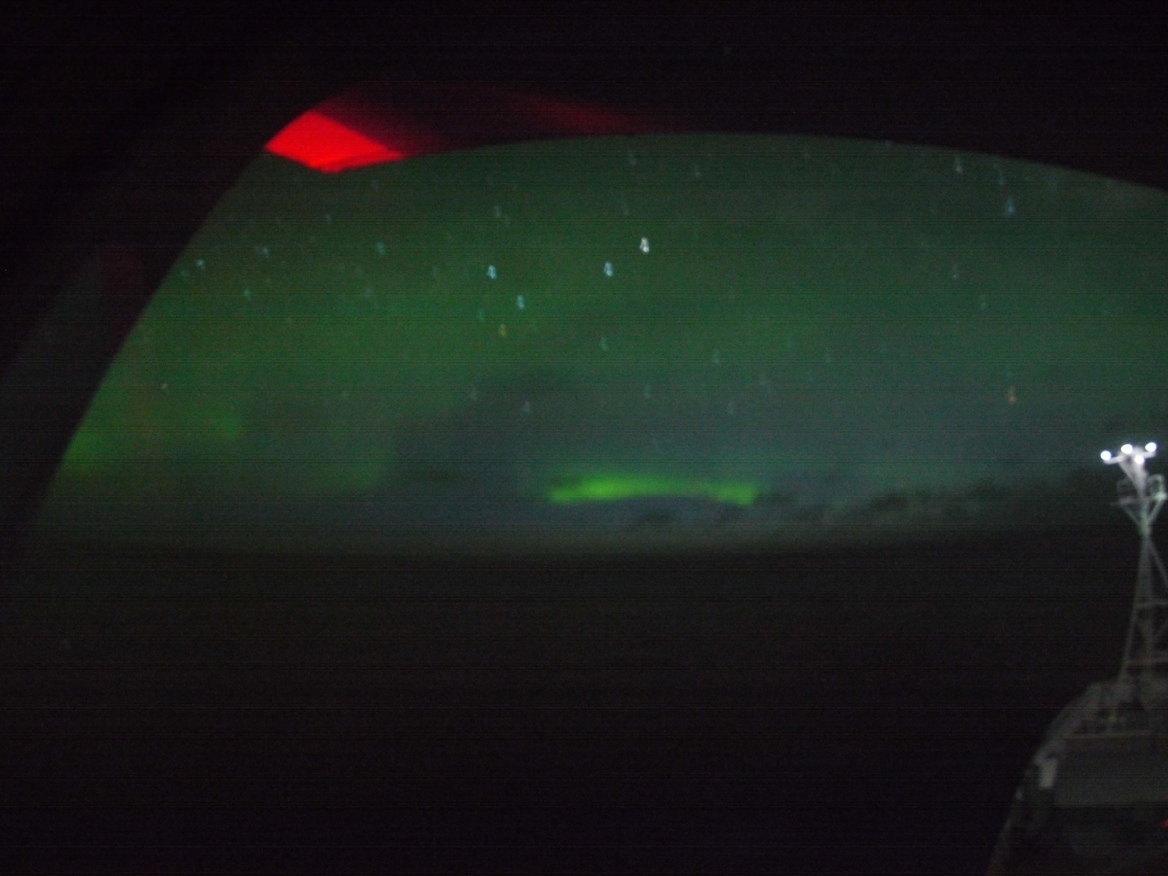
I have never spent more than a couple hours at sea before this voyage. The closest experience I have had is probably the half-an-hour ferry ride from Circular Quay to Manly Beach in Sydney. Unsurprisingly, I got really seasick on the first week and it was quite debilitating. Even today I still haven’t quite found my sea legs and have to rely on those seasick pills. But on a good day now I can survive on just half a pill. So it is improving!
If you can get over the seasickness, life at sea can be heaps of fun. Besides the exciting scientific work going on 24/7 on board, which I am sure has been covered in other blog posts, it is possible to see auroras when the conditions are right. It is one of the perks you get on a voyage in the Southern Ocean. I have never seen an aurora before, so seeing this faint green curtain hanging off the sky for the first time is just breathtaking. And, if you are lucky, you might see some interesting marine creatures while on board. Just the other day we spotted a small penguin cruising near the ship. I didn’t get to see it for myself though, but I still got very excited. Hope there’s a chance to spot one again later in the voyage!
Going on a scientific voyage is an unforgettable experience, and more so if it is the first time. I feel honoured to be able to participate, and be a part of scientific advancement. Even if you get easily seasick like me, you can still come back with lots of interesting stories to tell. Just make sure you have your pills with you.
 I am a PhD student at IMAS-UTAS, onboard the MNF/CSIRO’s state-of-the-art RV Investigator. This is my second month on a Southern Ocean voyage, so I am no stranger to life at sea on a research vessel. I study the vertical structure of mesoscale eddies and their contribution to north-south transport of heat, salt and nutrients across the Sub-Antarctic Front. I am focusing on the area south of Tasmania.
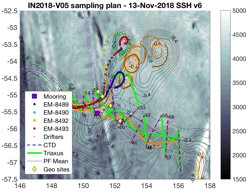
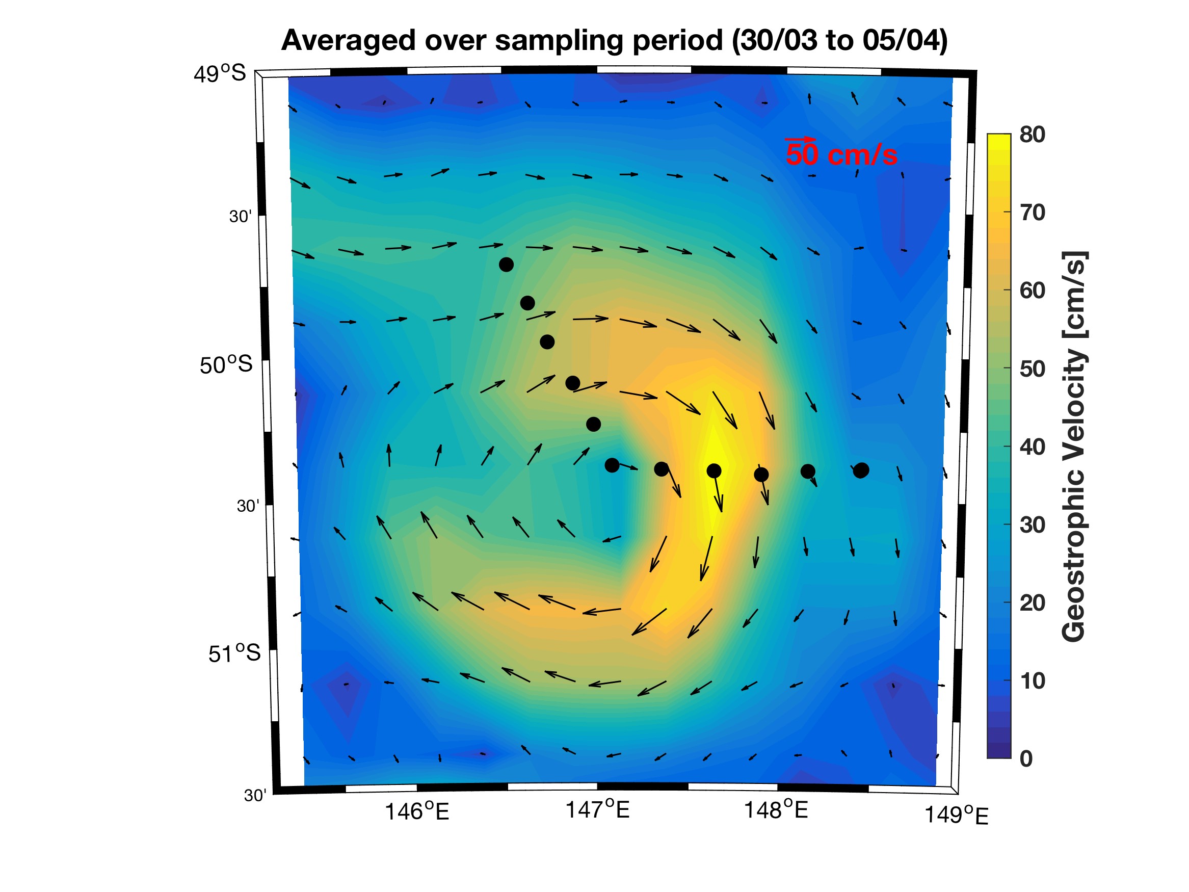
The obvious question is; ‘what is a mesoscale eddy?’ Mesoscale eddies are rotating bodies of water with diameters between 10-100 km that live from weeks to months in the ocean. They play an important role in the mixing of the ocean including the transfer of heat and nutrients. A snapshot of a Southern Ocean eddy is shown in the image below. The Macquarie meander voyage I am currently part of is closely related to my PhD project as the meander we are sampling in this voyage is one of the sources of eddy formation in the Southern Ocean.
Image, above right: Clockwise rotating mesoscale eddy that was sampled in the Southern Ocean south of Tasmania. Colour-shading shows velocity speed and arrows show its direction. Image is prepared using velocity calculated from the satellite altimetry data. The image is taken from Patel et al. 2018 (Submitted to JGR Oceans).
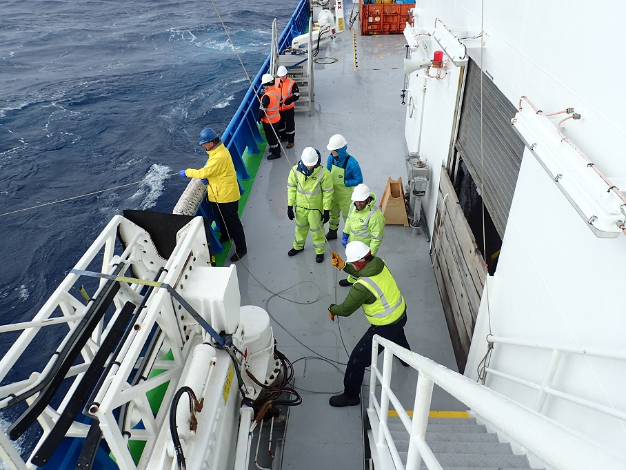
 In this voyage, my role is to collect CTD (Conductivity-Temperature-Depth profiler) water samples, and track eddies using satellite altimetry data. I was also a part of the team who deployed EM-APEX float and Surface Drifters. We deployed six EM-APEX (EM, Electromagnetic Autonomous Profiling EXplorers) float and six Surface Drifters. We will deploy four Surface Drifters later in the voyage.
(Pictured, left,deployment of a surface drifter. Photo: Sarah Lanier)
The Surface Drifters that we deployed, are a part of NOAA’s Global Drifter Program. The drifters are mainly comprised of a surface float and tethered drogue. The surface float is equipped with transmitter and thermometer. The thermometer measures surface temperature within a few centimeters blow the air-sea interface and transmitter transfer the position of the float and measured temperature to relay data via satellite. The other entity that is derived from the drifters is surface current as they move with ocean currents. Therefore, they are handy to measure ocean surface circulation at unprecedented resolution as well as they are also used to test accuracy of satellite based sea surface temperature measurements. Furthermore, they are useful to track oil spills and can provide information for marine rescue. The deployment of the drifters is straight forward. Just bring the drifter to the deck and gently throw it away from the ship in a way that it lands on drogue while ship is moving at around 5 knot speed as shown in the photo.
 I joined the RV Investigator cruise to the polar front in order to better understand ocean turbulence measurement methods. I am a Physical Oceanography PhD candidate in the Massachusetts Institute of Technology - Woods Hole Oceanographic Institution (MIT-WHOI) Joint Program and I am broadly interested in the apparent connection between small scale turbulence and the large scale vertical circulation of the abyssal ocean. Understanding the turbulence driven upwelling patterns of deep waters is critical for understanding climate change because of the deep ocean’s role in sequestering heat and carbon.
On the RV Investigator my role is to assist Dr. Kurt Polzin of WHOI with Vertical Microstructure Profiler (VMP) deployments (Pictured, above). The VMP measures some of the same turbulence statistics that I generate with supercomputer simulations of turbulence for my PhD thesis. The instrument gets its name because it free falls vertically through the water column, measuring small scale (micro) motions, so it produces vertical profiles of flow “microstructure.” It can be used to determine whether bursts of turbulence are decreasing the stratification (“mixing” up the density layers) or not affecting the stratification. The arduousness and expense of taking these measurements has further impressed upon me the value of the relatively scarce amount of turbulence data that we have from the ocean.
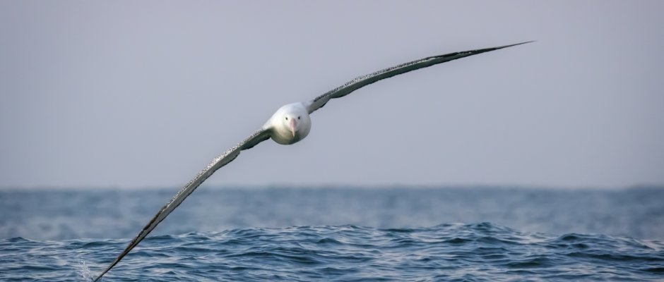 Deploying the VMP requires hours on deck, and in that time I have been fortunate to watch the Albatrosses bank, turn, and glide over the waves. Minutes, even hours can go by without seeing an Albatross flap its wings. Aerodynamic drag (friction) acts to continually slow the Albatross’s movement, which reduces the amount of lift that it can generate. Therefore if the Albatross doesn’t flap to increase its speed, can it glide indefinitely? The answer is quite complicated, but I will attempt a simple explanation of the primary dynamics. The wind speed is low near the ocean waves than higher up because the ocean exerts a frictional force on the wind (the opposite is also true). When an Albatross glides upward, into the wind, from the sea surface the wind speed felt by the Albatross increases. As the Albatross banks and turns, maintaining the same elevation, what was a headwind becomes a tailwind, accelerating the Albatross in the downwind direction. Finally, when the Albatross drops back to near the surface where the wind is low, it is moving faster than when it started the loop. It can either glide quickly across surface in the low wind region or glide back up to repeat the process. This process is called wind-shear soaring, and it is thought that Albatrosses use it to propel themselves across vast oceanic distances without ever flapping.
Having never been at sea before, what struck me most immediately were the sounds. I’m staying in room 102, which is on the lowest accessible level of the ship, on the starboard side closest to the bow. Located almost directly above the fuel and ballast tanks, the floor is about even with sea level, with only the hull separating me from the frigid water outside.
Living among the intersections of fluid and metal, there is a constant drum of slosh, thud, rattle, creak, repeat. Combine this with the multitude of other mysterious noises from winches, engines, below-deck scientific instruments, and other unknown machinery, and you might begin to understand that it was difficult to sleep the first few nights on board. After a week, however, the confluence of sound in this room has developed patterns and rhythms that are quite soothing, and which I think I’ll miss after the voyage is over.
My shift starts at 2pm. Without any windows to open, waking up at noon in pitch dark continues to be a very disorienting experience. The sounds are always what I notice first each day, reminding me that I am in the middle of the Southern Ocean.
I made this video from footage and audio I recorded in room 102 to try to capture the feeling of being here. It was shot on my cell phone, so audio quality is less than ideal. I would recommend headphones for best effect.
 I am a PhD student at IMAS, studying phytoplankton using ‘ocean color’ satellites and in-situ observations. This voyage is not directly related to my PhD, however it puts the data which I use day-to-day into perspective, and I am gaining valuable hands-on experience in collecting these green(ish), single cell plants. Besides creating over 50% of Earth’s oxygen, phytoplankton are the base of the ocean food-web and understanding how they change through space and time has consequences as far reaching as the climate, through carbon uptake and redistribution.
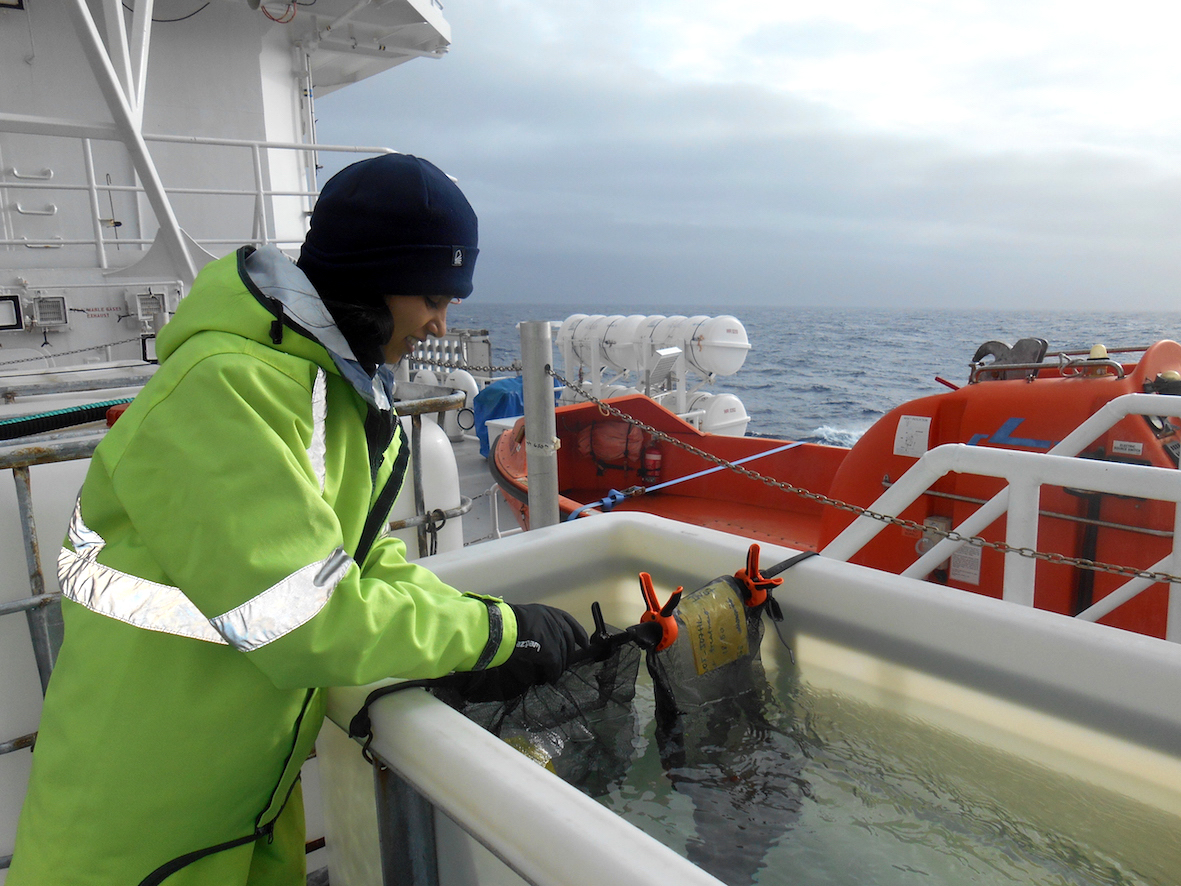
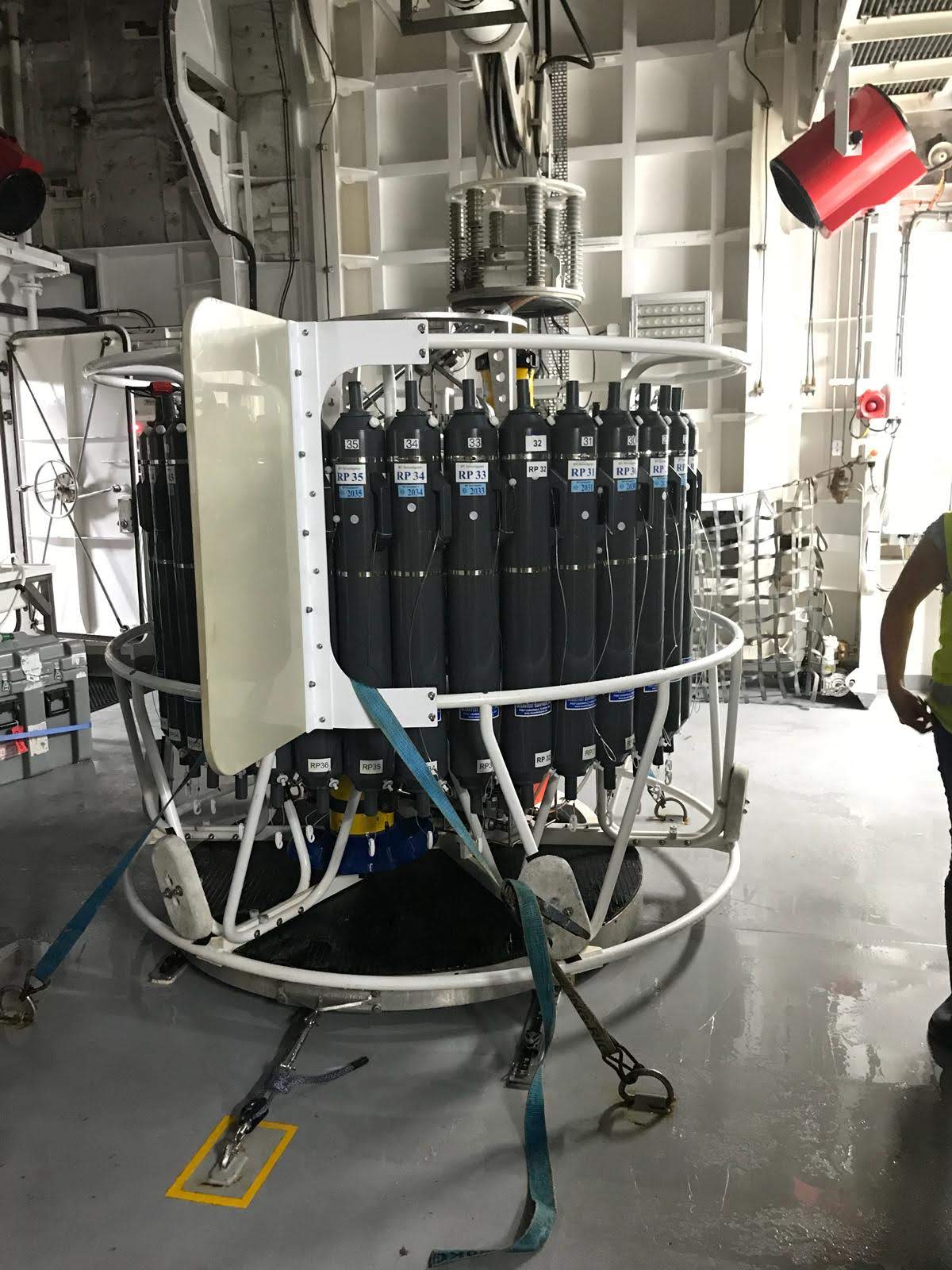
In the biogeochemistry team onboard, we are interested in how the standing meander, which we are visiting on this trip, affects nutrient upwelling and biological productivity. We are specifically interested in the surface 200m of this region in the ocean. We collect water samples from the CTD, which is an instrument holding 36 niskin bottles attached to a rosette.
The CTD is lowered to the ocean floor ~4km below us, capturing 36 x 12L water samples in these bottles. The  biogeochemistry team then run the surface samples through a hi-tech 1 micron (0.0001cm) vacuum filter to collect the phytoplankton cells and then frozen in a -20C freezer for at least a day. The concentrated cells are then placed in a special machine called a fluorometer that tells us how much phytoplankton there is present per water volume by using certain wavelengths of light which the phytoplankton reacts with as it tries to photosynthesise.
Ocean fieldwork is exciting and groundbreaking but often a little repetitive and nauseous for some. I typically spend my days at my desk programming, so it is great to get out and do some fieldwork. This is my second month at sea performing oceanography fieldwork and I will certainly be back to help tackle some of climate science and oceanography’s biggest questions in the future.
 Hello, I am Laura and I recently finished my undergrad study in Geology in Minnesota, US. Minnesota is a land locked state so this is my first time at sea, let alone on a research vessel voyage.
One of the main operations onboard is deployment of the CTD (pictured, below). CTD stands for conductivity (salinity), temperature, and depth of the water where a sample is taken. This CTD has 36 bottles around the main frame of the instrument, making up the rosette. A CTD cast takes about 4-hours from the moment the instrument is lowered into the water, reaches the sea floor, and is returned on deck.
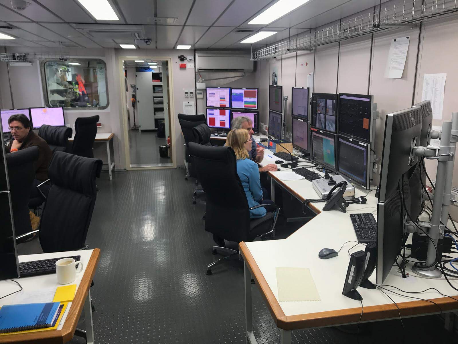
 On our first full day at sea, we did a test deployment of the CTD to almost the bottom of the ocean floor. The water is collected in the bottles starting from the bottom of the deployment and going up because of the pressure exerted on the bottles that the water goes into. During the deployment of the CTD, we are in the operations center (pictured, above) watching the CTD lower into the ocean. For the first test, it was lowered to approximately 4200 meters.
Once the CTD reaches the maximum depth, we communicate with the winch operators who lower and raise the CTD. At pre-determined depths, we close a bottle, collecting the water from that depth. We then record the bottle number that was closed and the pressure at the position for future reference.
Once the CTD is back on the vessel, we begin taking water samples for the dissolved oxygen, four different nutrients, and the salinity from each bottle. This process takes upwards of an hour as we steam to the next CTD station.
Throughout the voyage, we will repeat this process 89 times with the work split between the two 12-hour work shifts.
I am a student scientist onboard the RV Investigator. I am from the United States, but took a comparatively shorter flight to Hobart from Wellington, New Zealand, where I am doing my masters in Physical Oceanography for the year. This is my first time spending a month at sea on a research vessel but, as an avid sailor, I am no stranger to being on the water.
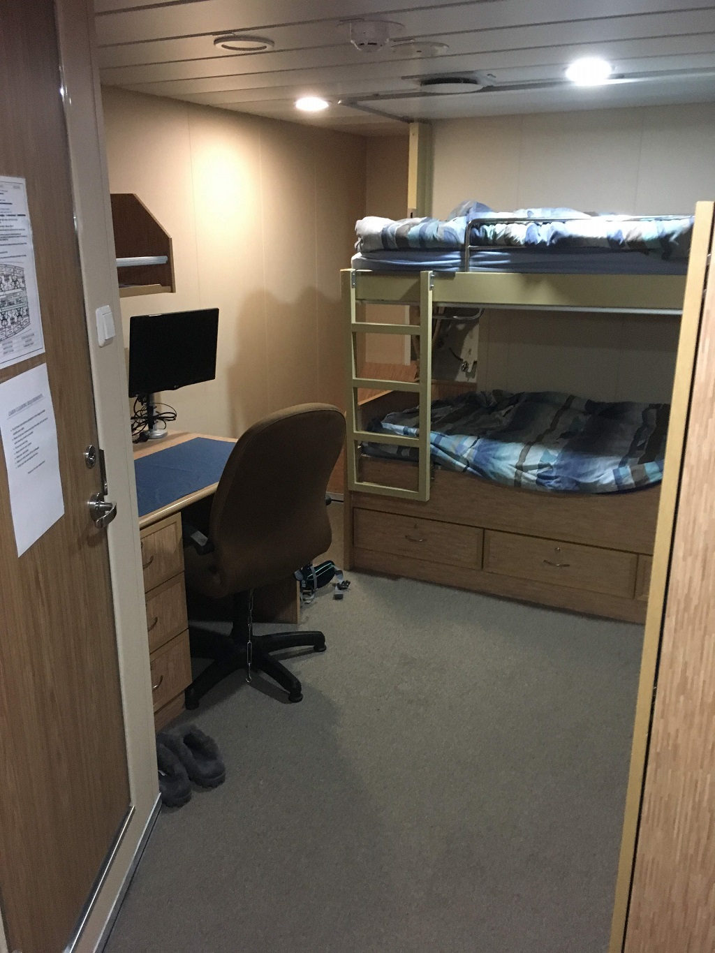
The day the vessel left port was very busy bringing equipment on board and getting everything ready for departure. Between helping bring everything on board, I had some free time and took the opportunity to visit the ship from the 1st platform, which is where my room (pictured, right) is located, up to the top levels.
 The top levels are the bridge, or the command platform, and the observation deck. I hope that we will see some whales or southern lights from up there during this trip.
Now, we have a few days at sea before reaching our initial destination and starting our 12-hour shift schedules, mine is from 2 pm until 2 am. During this time, we are getting used to life onboard and starting to learn our tasks.
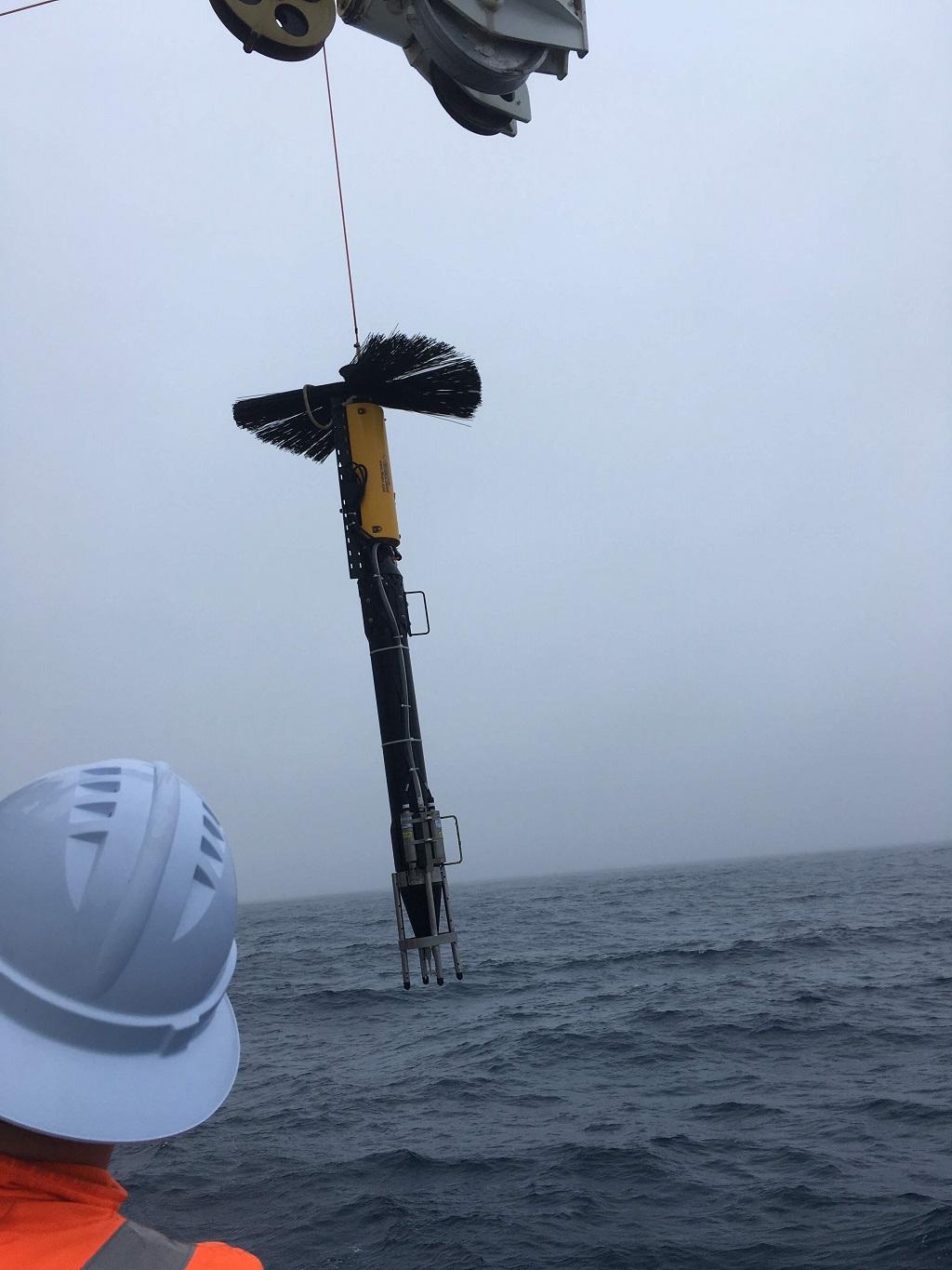
One of my roles will be working with the VMP (pictured, left) , a vertical microstructure profiler. The VMP is a long black instrument that free falls through the water column measuring velocity shear and temperature variability on the vertical scale.
The instrument is equipped with microstructure velocity probes, high-resolution temperature sensors, and high-accuracy CTD sensors. For now, we have done bench top tests in preparation for the first test deployment tomorrow.
Institute for Marine and Antarctic Studies
Phone: +61 3 6226 6379
ABN: 30 764 374 782 CRICOS Provider Code: 00586B