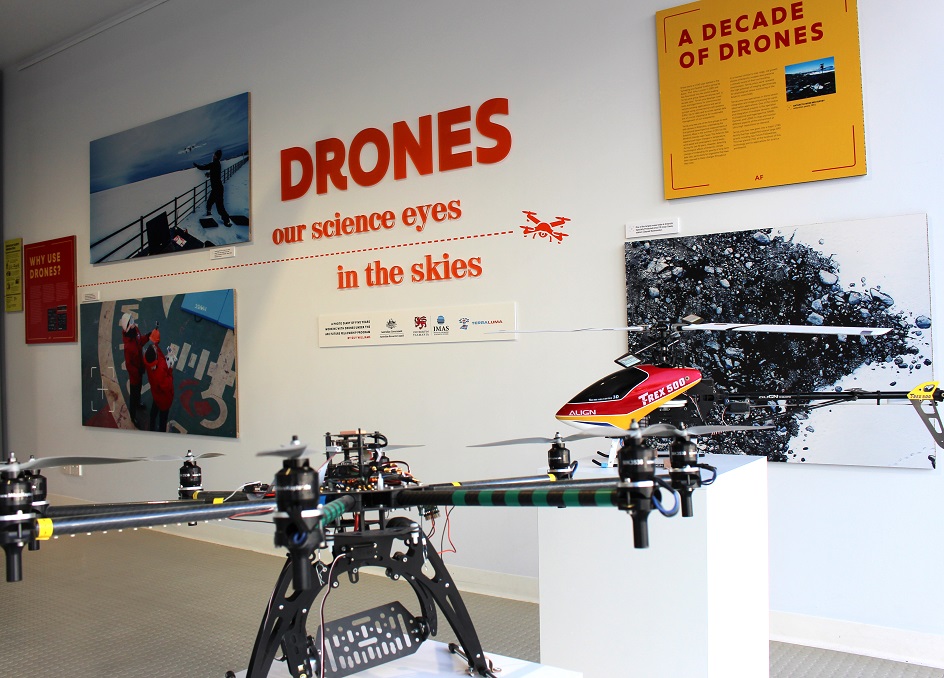
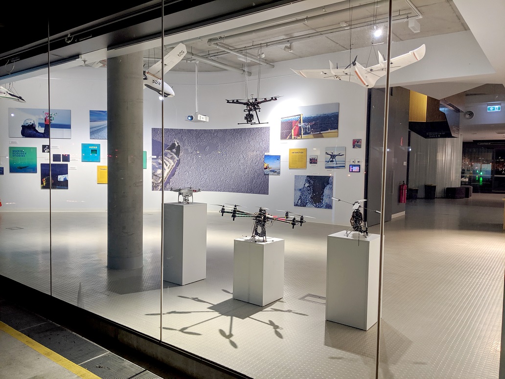
A new exhibition at the IMAS waterfront building in Hobart is highlighting the increasing use of drones in science, particularly for Antarctic and marine research.
Open to the public 9am-5pm Monday to Friday until late-September, the exhibition “Drones: our science eyes in the skies” explores the rapid growth in the use of drones to study subjects as diverse as the extent of Antarctic sea ice and the biology of whales.
The exhibition includes drones that have been used in the field, photos and video, and posters explaining the University’s drone research.
Associate Professor Guy Williams, who specialises in developing autonomous platforms for Antarctic research and helped to create the exhibition, said advances in drone technology promise an exciting new era for science.
“This exhibition is a great chance for members of the public to get a unique insight into the new research opportunities that drones are creating,” Associate Professor Williams said.
 “Drones allow us to deploy sensors and collect data cheaply and safely in places that until now have been too dangerous, too remote or too expensive to reach.
“Improving technology means drones can now fly further and for longer while carrying heavier sensing equipment.
“In Antarctica, drones have potential to help answer urgent questions about dramatic regional changes in sea-ice, and to address the mismatch in climate models.
“We have also used drones to survey Short-tailed shearwater (muttonbird) colonies off Bruny Island and to sample breath from the blowholes of Blue Whales in the Southern Ocean.
“Our next big challenge is to develop drones that can fly beyond the visual line of sight (BLVOS) of the operator, enabling even longer flights.
“The University has approval to conduct trial BLVOS flights to islands up to 10 kilometres off Tasmania to survey seal and seabird colonies, something that just wouldn’t be possible without this technology,” Associate Professor Williams said.
The University first began experimenting with drones in 2009 through the TerraLuma Research Group led by Associate Professor Arko Lucieer (School of Technology, Environments and Design).
“Over the last 10-years the University’s use of drones has grown and covered many applications, including precision agriculture, vineyard mapping, forestry, landslides, coastal erosion, and mapping of complex ecosystems,” Associate Professor Lucieer said.
“Our world-leading research in sensor integration and image processing has allowed us to collect images and three-dimensional data at resolutions in the order of several centimetres. This ‘ultrahigh-resolution’ imagery can provide us with new insights that satellite sensors are unable to offer
“The drone sensing platforms that we have developed include hyperspectral, thermal, and laser sensors that allow us to detect information that is invisible with the naked eye.
“Science is built upon observations and data, and by allowing us to increase the scale and scope of our observations drones are helping researchers to better understand the world around us,” Associate Professor Lucieer said.
Institute for Marine and Antarctic Studies
Phone: +61 3 6226 6379
ABN: 30 764 374 782 CRICOS Provider Code: 00586B