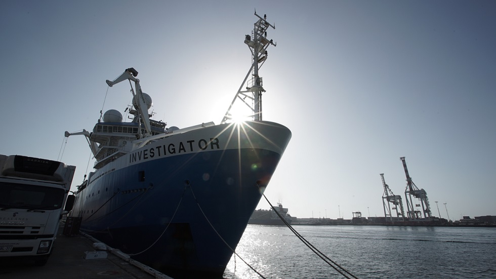
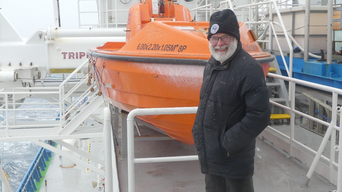
An IMAS-led research team on the CSIRO research vessel Investigator sailed from Perth on 10 January for a two-month voyage that could lead to Australia’s marine jurisdiction near Heard Island being extended by an area the size of Switzerland.
The main focus of the voyage is to study the ancient rifting, break-up, and separation of tectonic plates that split a giant, once-contiguous oceanic plateau into two major Indian Ocean seafloor features, Broken Ridge and the Kerguelen Plateau, to the west and southwest of Perth.
The science team includes researchers from 13 institutions and 11 nations, including Australia, Canada, China, Denmark, Germany, Italy, Poland, Singapore, Turkey, UK, and USA.
The scientists will also acquire, analyse, and interpret samples from William’s Ridge, a seafloor feature that extends southeast from the Kerguelen Plateau, to establish whether the area qualifies under international law to be included in Australia’s marine jurisdiction.
If judged eligible by the United Nations Commission on the Limits of the Continental Shelf (CLCS), it could add 40,000 square kilometres to the continental shelf recognised as part of Australia’s jurisdiction.
The voyage’s Chief Scientist, IMAS Professor Mike Coffin, said the seafloor of the Indian Ocean has undergone a complex evolution since it began forming more than 150 million years ago, and the geological events involved are an enigma.
“Like other oceans, the Indian Ocean has formed by seafloor spreading among tectonic plates,” Professor Coffin said.
 “However, to the west and southwest of Perth this seafloor spreading interacted with hotspot volcanism, where magma rising from deep within the Earth has created oceanic crust much thicker than normal as the plates have broken up.
“During the voyage researchers from Australia, China, Denmark, Germany, Italy, Russia, and USA will carry out a wide range of imaging and sampling techniques to acquire data and samples using the Investigator’s cutting-edge technology.
(Image, above, RV Investigator crew with a towed camera in the Southern Ocean, January 2016. Credit: Pete Harmsen)
“An exceptional multidisciplinary team of international scientists will subsequently analyse the data and samples to improve our understanding of parts of the seafloor that have never been studied in this level of detail.”
Professor Coffin said consideration of the possible extension of Australia’s marine jurisdiction around William’s Ridge has been on hold due to a lack of sufficient data and samples from the continental shelf.
“The data and samples we collect will inform a possible future submission to the CLCS to extend Australia’s marine jurisdiction to include the continental shelf on and around William’s Ridge, an extension of the Central Kerguelen Plateau near Australia’s Heard Island.
“The CLCS assessed Australia’s continental shelf entitlements from 2004 to 2008, but in 2008 consideration of this area was postponed at Australia’s request due to the shortage of relevant geological samples and geophysical data.
“Whether William’s Ridge is eligible to be continental shelf is unknown, as are the geological processes that led to its development.
“Our voyage will for the first time carry out detailed investigations of the ridge, including multibeam bathymetry, seismic imaging, sub-bottom-profiling, dredging of rock samples, and deep towed-camera footage.
“This comprehensive and unique data and sampling will help the CLCS to decide whether Australia’s marine jurisdiction should be extended by an area the size of Switzerland,” Professor Coffin said.
The voyage will include scientists and students from Geoscience Australia, Macquarie University, University of Queensland, Australian National University, GFZ German Research Centre for Geosciences, James Cook University, University of Western Australia, College of the Atlantic, and Institute of Oceanology, Chinese Academy of Sciences.
The project also involves shore-based researchers from the Alfred Wegener Institute for Polar and Marine Research, University of Cambridge, Oregon State University, Natural History Museum of Denmark, and GEOMAR Helmholtz Centre for Ocean Research Kiel.
Investigator is Australia’s only research vessel dedicated to blue-water research and is owned and operated by CSIRO – Australia’s national science agency. The vessel conducts research year-round and is made available to Australian researchers and their international collaborators.
The voyage is scheduled to return on Friday 6 March.
The passage of time seemed to accelerate as we entered our final (short) week at sea. Our last full day of work over Broken Ridge encompassed seafloor mapping and three dredges, all successful. We partially mapped the second deepest region of the Indian Ocean, Dordrecht Deep in the Diamantina Zone, that exceeds 7,000m. The transit to Fremantle commenced early in the morning on 3 March. En route we deployed four robotic floats for the international Argo program.
During the transit, the science party was occupied with wrapping up shipboard analyses, packing samples, finalizing shipboard data and metadata compilations, and synthesizing initial results. We sailed into Fremantle on a glorious early autumn morning, Friday 6 March, and our 57-day voyage came to a seemingly abrupt end. Poignant reunions with family and friends will have to wait for everyone but our Perth-based student; such gratification will be deferred for all 55 others who reside interstate and internationally. Demobilisation was mostly completed the day of our arrival, although all rock and sediment samples will remain aboard Investigator until the ship returns to Hobart later this month.
 By the numbers, IN2020_V01 was a resounding success in meeting our research objectives. We mapped >100,000 km2 of seafloor, acquired 1,103 line-km of seismic reflection data, and completed 20 successful dredges. In doing so, we inaugurated Australia’s new seismic reflection capability, tested RV Investigator’s endurance, and exceeded several previous Investigator records. Despite our departure being delayed two days at the start of the voyage, our 57 days constitute the longest Marine National Facility voyage to date. We traveled more than 10,000 nautical miles, mapped more seafloor than any other voyage to date, conducted more deep (>4,000 m) rock dredges than any previous voyage, hosted a record 65 seminars, carried two medical staff (a first for a remote voyage), and possibly had the youngest (age 19) science party member to date.
All in all, in some of the most remote and tempestuous reaches of the global ocean, RV Investigator proved once again to be the highly capable, multi-purpose, dedicated research platform that Australia needs to enable researchers to address Australia’s most pressing marine scientific challenges of high societal relevance.
The world has changed since we embarked in early January. News of the widespread bushfires and flooding that have affected Australia, and of the COVID-19 virus impacting the globe, had reached us, yet the wider world was eerily remote after we had seen neither land nor anyone other than the 56 souls on board for the past 57 days.
Planning, executing, and supporting IN2020_V01 involved not only the 56 voyage participants, but also many, many people ashore: the 10 other principal investigators on the research project; MNF, ASP, and Aspen Medical staff; Australian Research Council, Australian Antarctic Division, and international funding body employees; university and agency support personnel; and the family and friends of the shipboard complement. We are extremely grateful to everyone for their incredible contributions to the success of the voyage! And we all look forward to future voyages aboard RV Investigator.
 The last full week of the voyage proved productive. We completed the final four (of five) seismic reflection transects of the southern flank of Broken Ridge over five days, undertook three successful rock dredges, and mapped more seafloor.
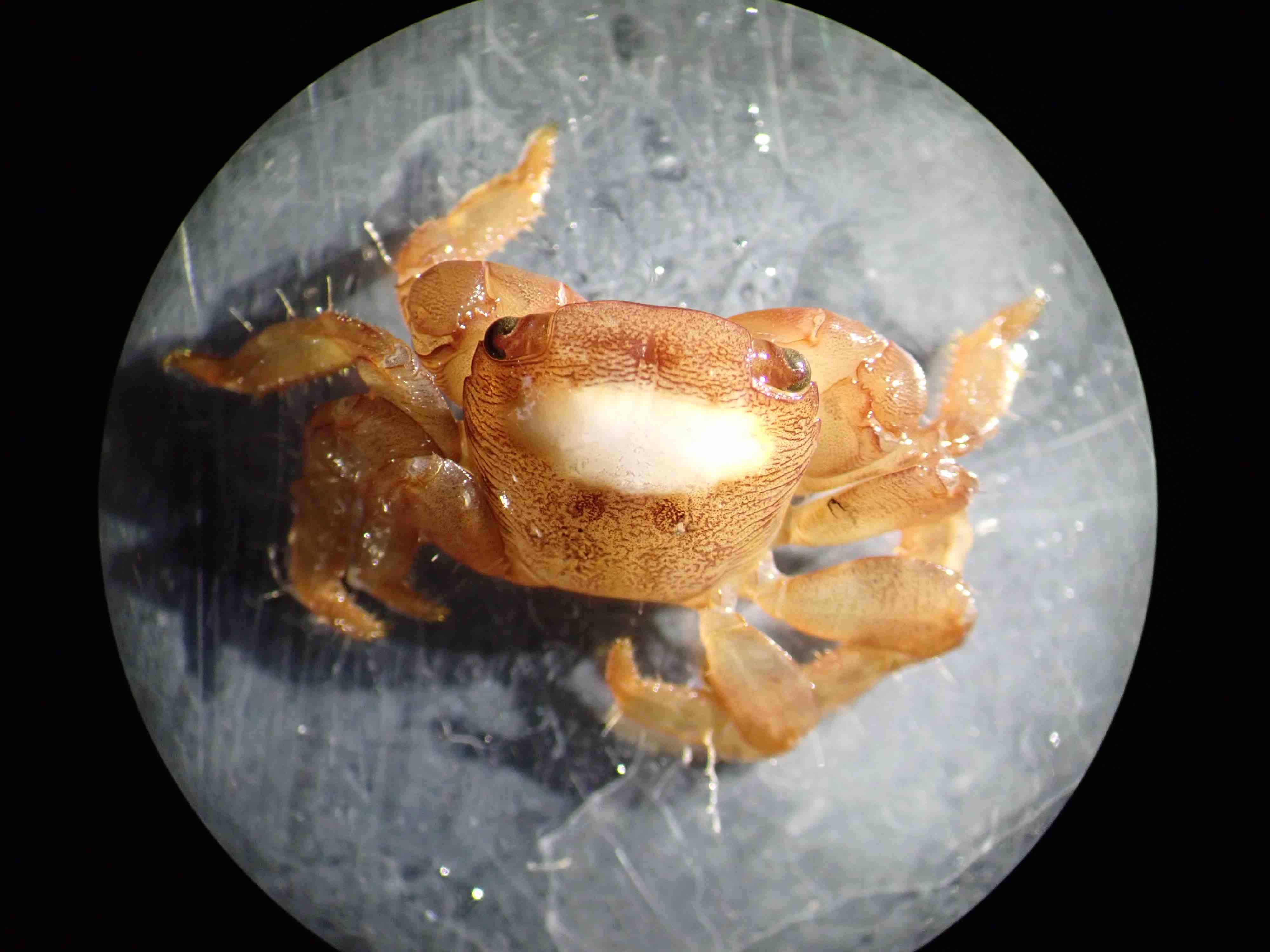
Our seismic program was not interrupted by weather, cetaceans, or fishing vessels, although we observed several longliners (Pictured, right. Credit David Dieckfoss), and had to deviate from one seismic reflection transect to avoid our seismic source and receiver snagging longlines. Our biology contingent, however, received an unexpected bonanza upon conclusion of the seismic program and final retrieval of the seismic streamer: the streamer’s tail buoy had snagged a ghost net hosting an ecosystem including crabs, barnacles, oysters, and a mussel. (Pictured, below left, red crab inhabiting the recovered ghost net. Credit: Sally Lau) The ghost net was brought aboard with all its biota, and we will return to shore with representative preserved samples.
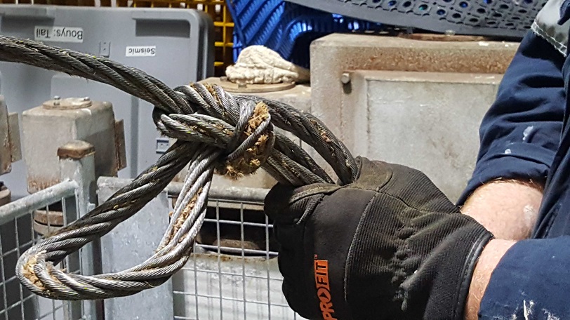
 Dredging rocks can yield surprises as well. Our final dredge this week somehow managed to tie a knot in its sacrificial wire, the weak link between the ship’s main cable and the dredge itself (Pictured, below right. Credit: Bridie Le’Gallais). As the name implies, the sacrificial wire is meant to break if the dredge itself becomes stuck on the seafloor, thereby not affecting the main cable. How the wire tied itself into a knot along the seafloor remains a mystery.
 As we approach the end of the voyage, we are devoting substantial effort to preparing various reports. We are working on a Voyage Scientific Highlights & Summary, a Chief Scientist Operational Report, and metadata forms. William’s Ridge (Kerguelen Plateau) falls within the area of the Convention on the Conservation of Antarctic Marine Living Resources (CCAMLR), requiring that a permit from the Department of the Environment & Energy be obtained pre-voyage and a report be submitted post-voyage. And funding support from the Australian Antarctic Science Program necessitates submission of a Data Management Plan.
The weekend’s last day of summer and first day of autumn reminded us that we spent the majority of the former aboard RV Investigator, 50 of 91 days. Although 3-4°C water (and similar air) temperatures over William’s Ridge didn’t feel much like summer, typical southeast trade winds and 20-something-degree temperatures over Broken Ridge have given us a taste of summer. On this voyage we are pushing the limits of RV Investigator’s endurance; stay tuned to see if we surpass the previous endurance record set in 2017!
 The transit from William’s Ridge to Broken Ridge lasted six days, taking us from the Furious Fifties and Roaring Forties into the horse latitudes. The two ridges formed as a single entity about 100 million years ago, and then rifted, broke up, and finally separated about 43 million years ago. Our work on William’s Ridge is illuminating half of that emplacement, rifting, breakup, and separation history, and our studies on Broken Ridge are revealing the other half of that history. The same fundamental processes controlled the rifting and breakup of these two ridges as govern the rifting and breakup of continents.
The advantages of the two ridges is that their crustal structure is far less complicated than that of continental crust, their structures are not deeply masked by thick sediment, and their crustal basement is readily accessible for sampling. The prospect of having excellent geophysical data and geological samples from the two conjugate ridges to advance our understanding of first-order rifting, breakup, and separation processes involving two tectonic plates is exciting!
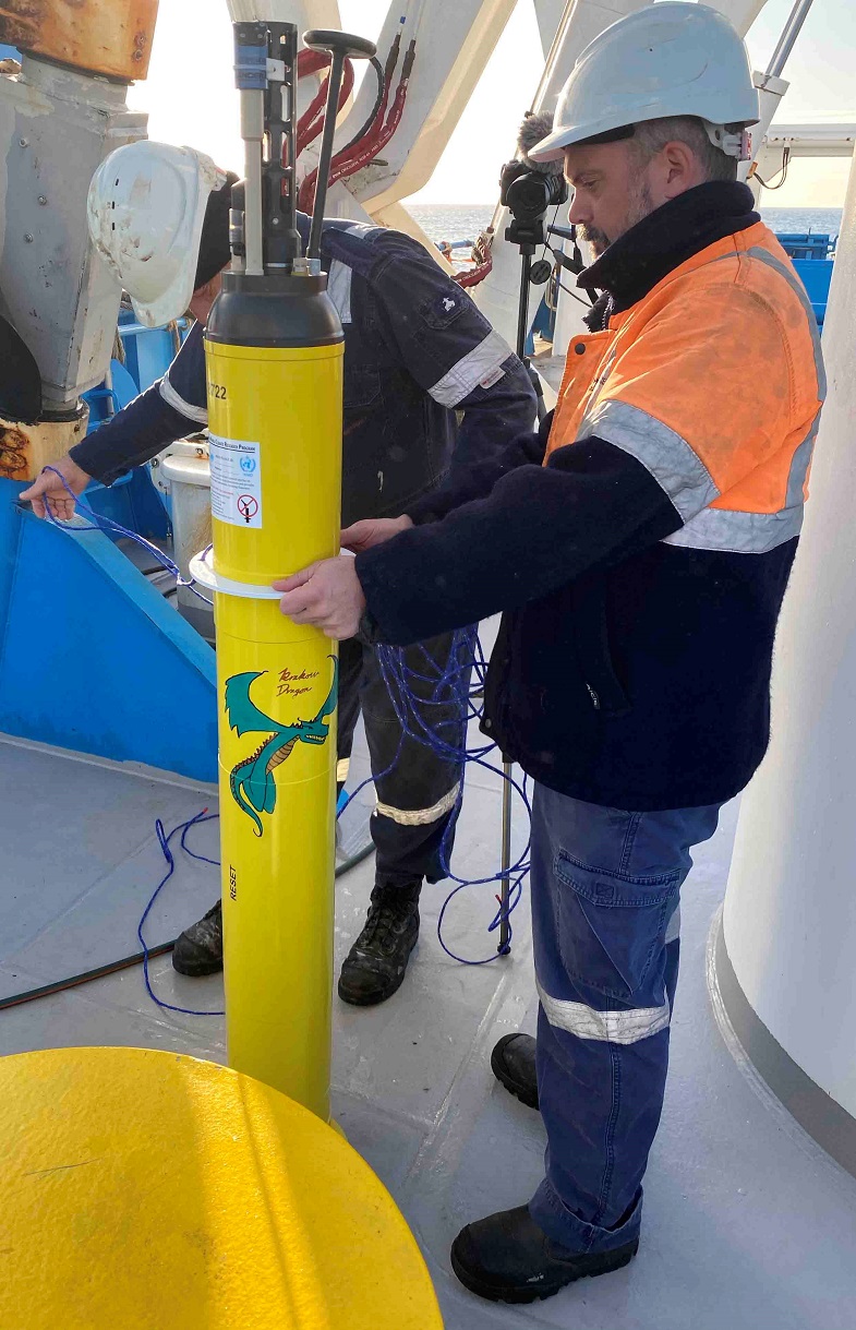
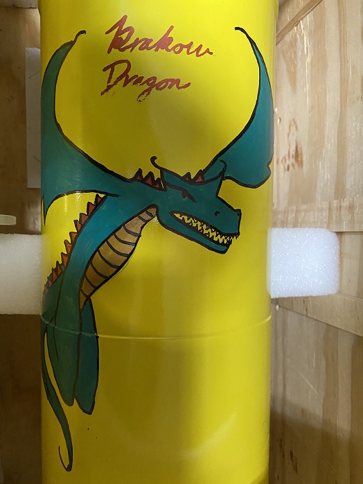 En route to Broken Ridge we deployed the last of our four SOCCOM (Southern Ocean Carbon and Climate Observations and Modeling) floats (Pictured, above right: SOCCOM float ‘Krakow Dragons’ being launched by ASP crew members Dennis Bassi (left) and Dan Morse (right). Year 7 students at Krakow Primary School #22 in Krakow, Poland, adopted this float and named it ‘Krakow Dragons’. A special treat of the transit was sighting a small pod of spouting sperm whales.
(Pictured, left: Float adornment by University of Tasmania exchange and University of Copenhagen undergraduate student Caroline Gram. Credits: Mike Coffin)
Along Broken Ridge we deployed the fourth of our eight Argo floats. Both types of floats provide records of temperature, salinity, and depth in the upper 2000 m of the ocean, and the SOCCOM floats are augmented with dissolved oxygen, nitrate, pH, and, in some cases, bio-optical sensors. Approximately 500 SOCCOM floats are active in the Southern Ocean, and about 3,800 Argo floats are operating in the global ocean.
 Our work program on Broken Ridge commenced upon arrival on 18 February, and to date we have completed one long seismic reflection profile and three dredges within the well-mapped search area for missing Malaysia Airlines flight MH370, and considerable multibeam/backscatter mapping and sub-bottom profiling along the strike of the mostly unmapped portion of Broken Ridge’s southern flank. Our plan for the coming week includes four more seismic reflection profiles, multiple dredges, and additional mapping and profiling.
During the week our Science Communicator David Dieckfoss (Pictured, above, aboard RV Investigator. Credit: Hadyn Titterton) organised direct communication with school students and teachers via a live video link for the second time this voyage. These links enable students to tour the ship, meet me and other participants, and pose questions about geoscience, marine governance, ship operations, life at sea, and other topics. More than 400 students from 15 schools representing years 4 to 12 have taken part, as well as a group of teachers undertaking professional development. Schools can download short videos, participant profiles, and other information for educational purposes (https://bit.ly/2Vm9nya).
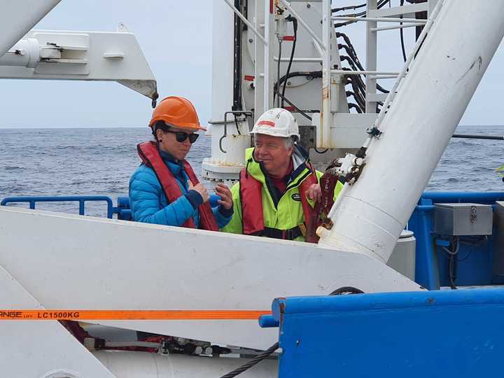 Every morning the voyage’s senior management team – Master Adrian Koolhof, Voyage Manager Tegan Sime, and I – meet, together with other key leaders, for about 30 minutes to discuss plans for the next 24-48 hours and any other matters of import. Communication is also frequent throughout the day. Organising, managing, and coordinating our respective teams is critical for effectiveness and efficiency as we conduct our diverse operations in changing environmental conditions. Many who aren’t on watch congregate at 1400 for our daily seminar series, at which anyone can speak on a topic relevant to our research program or of general interest.
(Pictured, left, Voyage Manager Tegan Sime and Chief Scientist Mike Coffin conferring on the aft deck of RV Investigator. Credit: Adrian Koolhof)
To date, 52 seminars have been presented by members of the science party, support team, ship’s crew, and medical staff. In addition to sharing expertise and knowledge with anyone who’s interested, the seminars stimulate conversation, give everyone and especially students the opportunity to hone their presentation skills, and foster team building among our disparate personalities, skill sets, nationalities, and ages.
 Favourable wind and sea conditions fostered a productive start to the week, with our final two seismic reflection profiles across William’s Ridge completed on 10 and 11 February. Thus on this voyage we acquired a total of four profiles across the entire feature, which are complemented by two profiles recently carried out by our colleagues aboard RV Sonne. An additional profile was undertaken from RV Rig Seismic in 1997, another voyage on which I participated. These seven profiles help reveal structural and stratigraphic developments during the rifting, breakup, and separation history of William’s Ridge and Broken Ridge.
Conditions were auspicious for sampling on 12 February, when we conducted our final two dredges close to the crest of William’s Ridge. The rocks we’ve recovered from a total of nine dredges on William’s Ridge and three dredges on Rig Seismic Seamount will help us understand the features’ relationship to the main Kerguelen Plateau, and to Heard and McDonald islands.
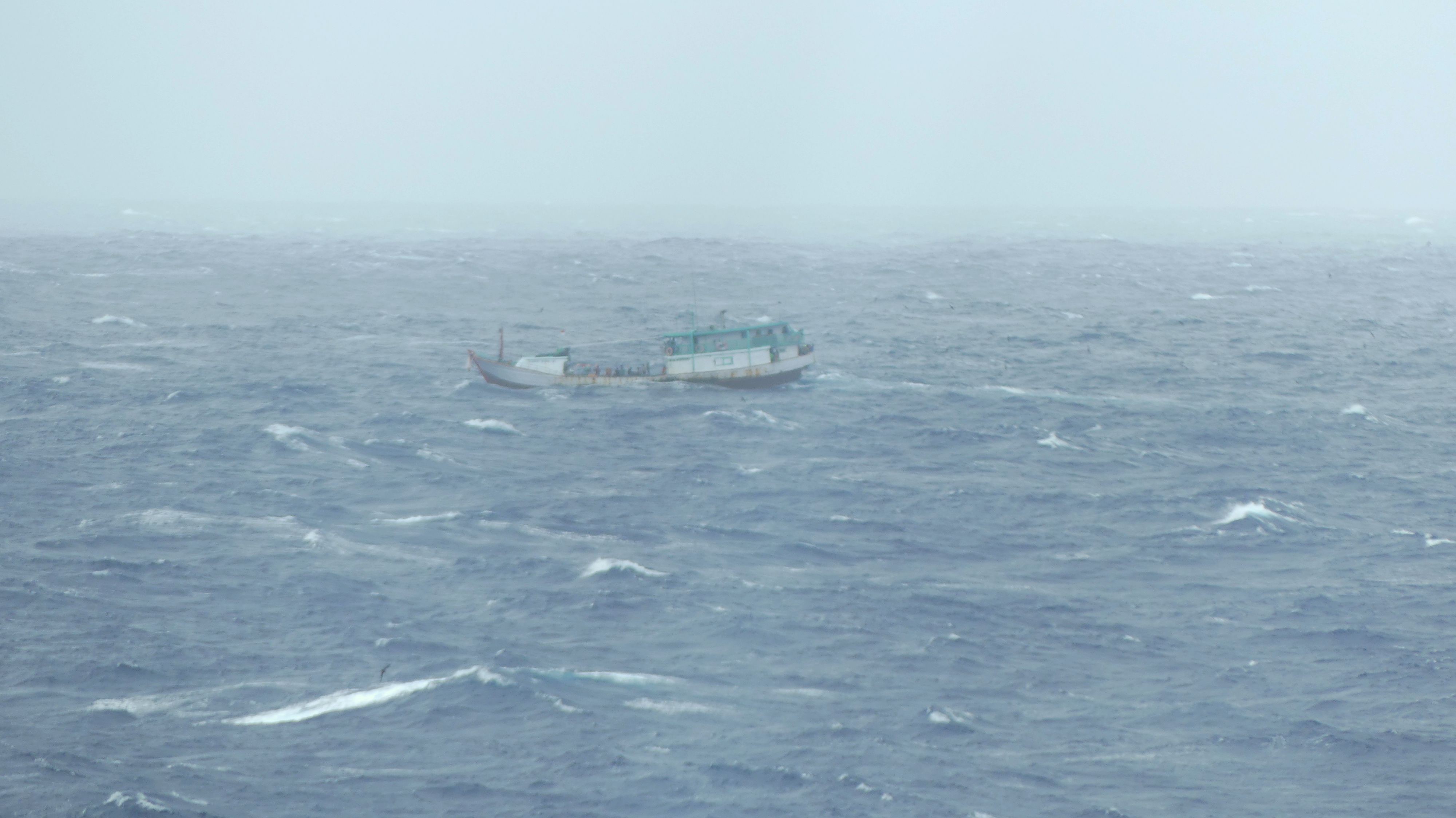
 After securing the rock dredge and seismic reflection system in the early morning hours of 13 February, we set a course for Broken Ridge and began the long ~1,450 nm / ~2,700 km transit north. We breathed a collective sigh of relief later that day when we left the Furious Fifties for the Roaring Forties, but the latter held something tempestuous in store for us on Valentine’s Day: a weather system with winds up to 61 kts and waves up to 10 m.
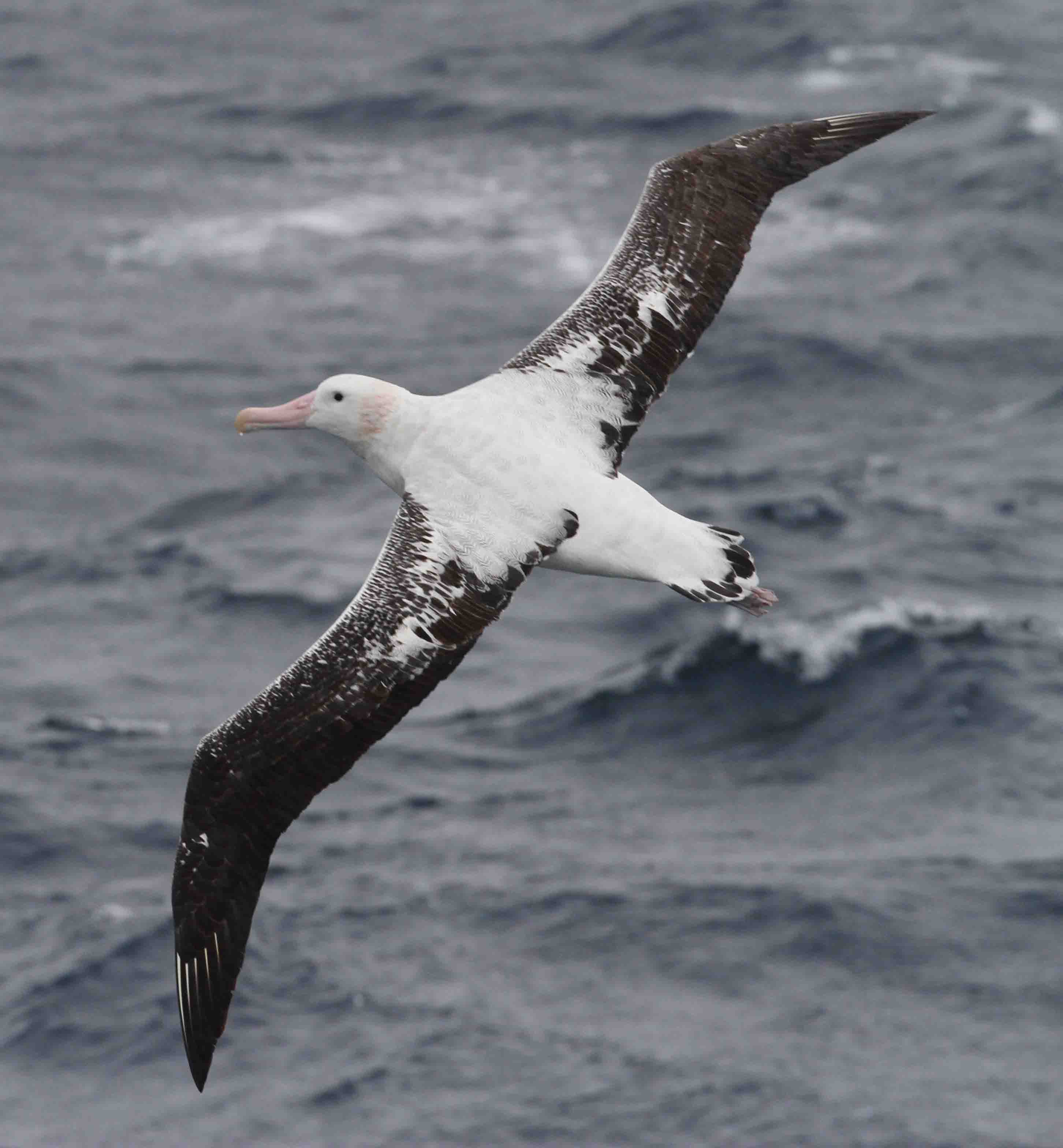
(Image, left: Wandering albatrosses (Diomedea exulans), with up to 3.5 m wingspans. Credit: Paige Maroni)
Those conditions forced us to heave-to, or essentially park the ship heading into the waves and wind, and we endured many hours of considerable pitching. The worst of the violent storm had passed by the morning of 15 February, and we were then able to resume our transit towards Broken Ridge, albeit delayed by ~19 hours due to the tempest.
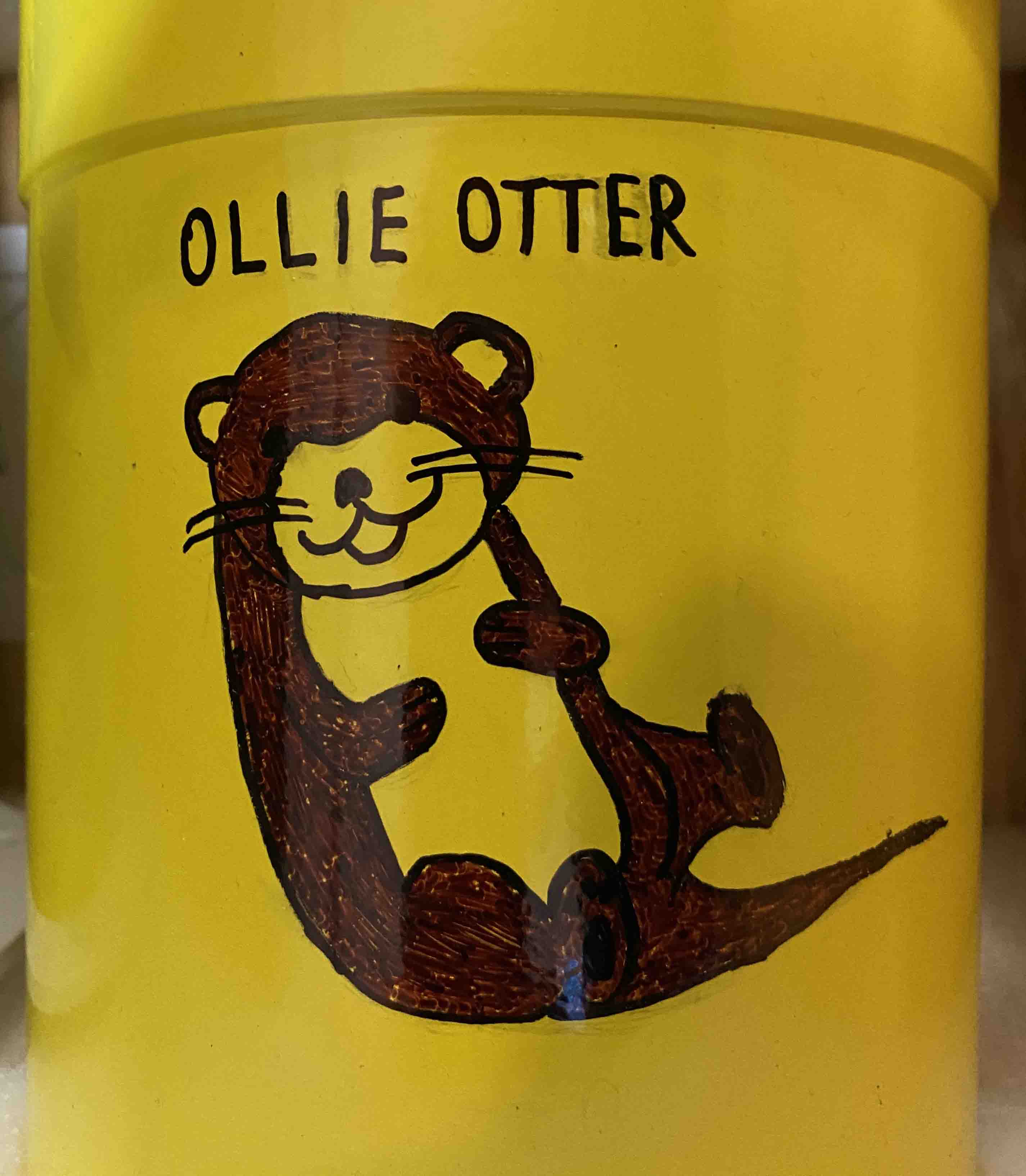
Later on 15 February, we deployed our third SOCCOM (Southern Ocean Carbon and Climate 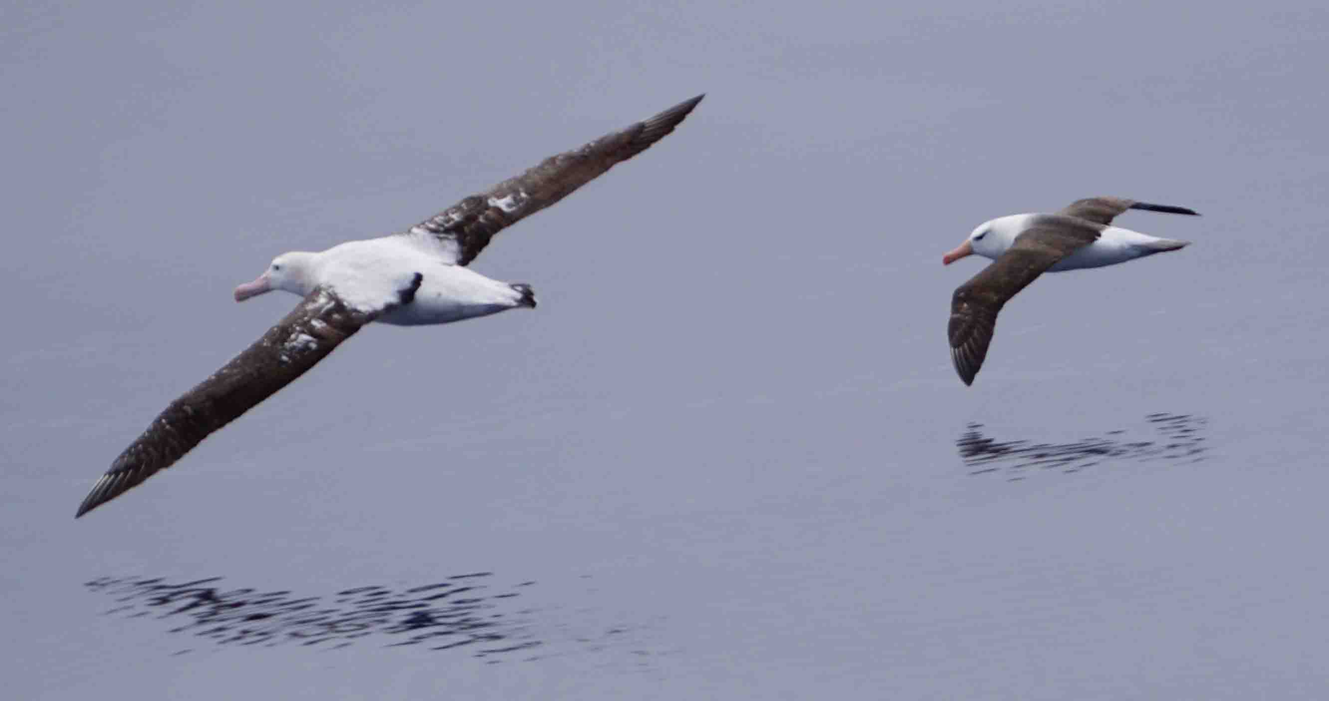 Observations and Modeling) float. Year 4 students at the Robert Down Elementary School in Pacific Grove, California, USA, adopted this float and named it ‘Ollie Otter’ (Image, top right: SOCCOM float ‘Ollie Otter’, adorned by University of Tasmania undergraduate student Sylvie King. Credit: Mike Coffin).
Albatrosses have been our constant companions in the Roaring Forties and Furious Fifties, and the majestic grace of these creatures is best observed first-hand and close-up whilst at sea.
(Image, above right: Wandering (Diomedea exulans) and black-browed (Thalassarche melanophris) albatrosses flying in formation. Credit: Jai McKay)
No matter what the wind strength, their apparently effortless gliding – to and fro, hither and yonder, their wings at times infinitesimally proximate to the water – conveys a sense of tranquility, stability, and serenity. With lifespans not dissimilar to humans, one can’t but wonder how the life experiences of wandering albatrosses compare to ours.
Investigations over William’s Ridge continued during the week, both underway acoustics and dredging. Remote sensing of the seafloor illuminated the surficial structure of the feature and potential sites for dredging rocks. Dredging at multiple sites from 3-5 February recovered igneous, sedimentary, and metamorphic rocks, as well as accompanying sediment and biota from the seafloor.
 Winds of up to 56 knots and wave heights up to 7.5 m precluded both dredging and seismic operations from 6-9 February, so we continued to map William’s Ridge seafloor the final four days of the week.
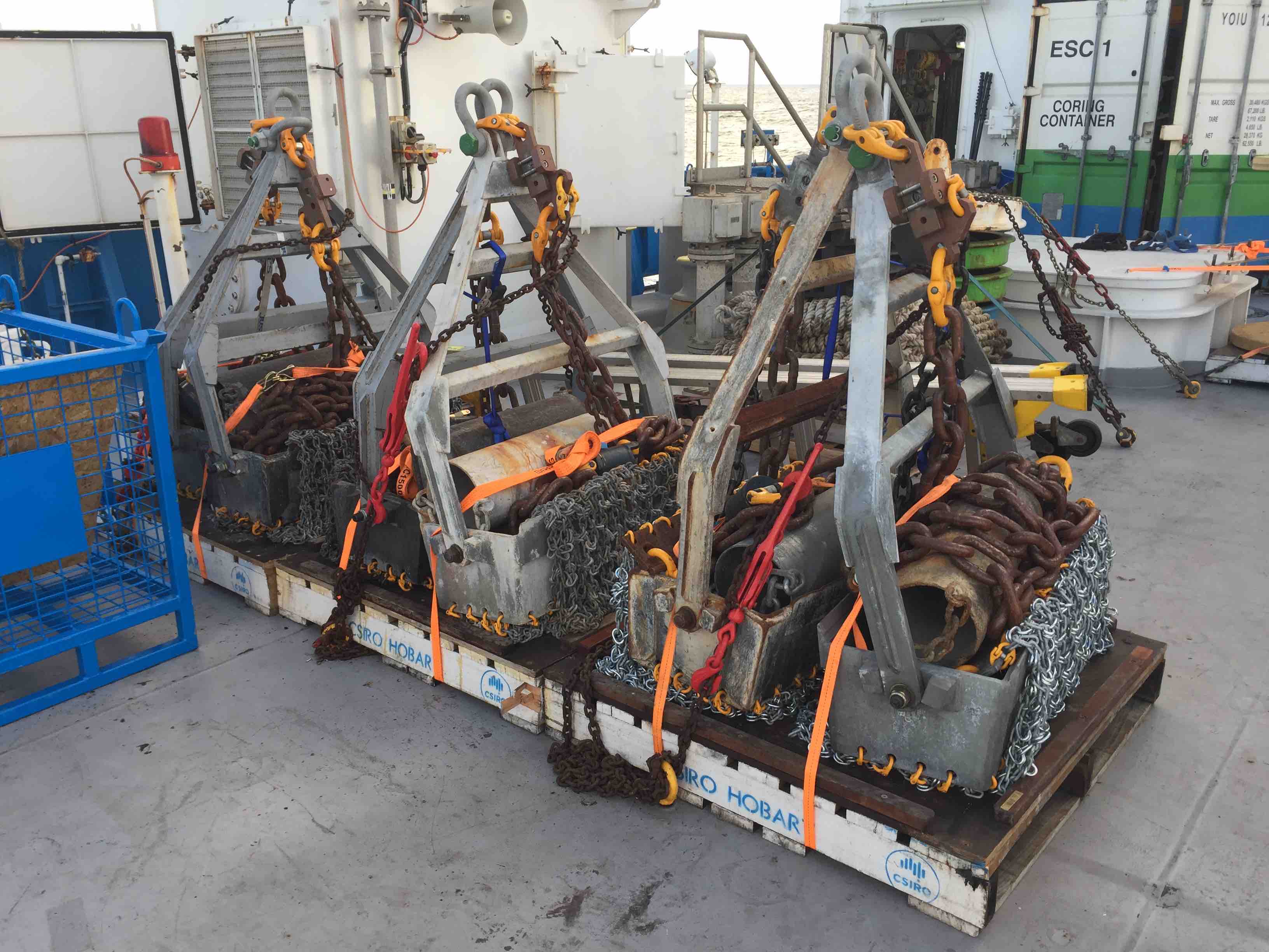
(Image, right: IN2020_V01’s full complement of six rock dredges stored for transit before the first deployment. Credit: Mike Coffin)
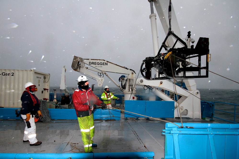
Dredging is a relatively primitive and cost-effective means to obtain rock samples from the seafloor. The technique is straightforward: a metal net is attached to the end of a cable and then deployed from the ship down to the seafloor. The net is then dragged along the bottom by a combination of ship motion and winching the cable in and out. After being dragged along the seafloor, the dredge is winched back up to the ship.
 Dredging requires considerable seamanship by the ship’s crew, able deck handling skills by the ship’s crew and field operations staff, and petrologic expertise by the scientists… and lots of help by students! So far on this voyage, we have occupied 11 dredge sites; 10 have returned rocks, and on 5 February our most recent dredge was lost.
(Image, left: A successful dredge being emptied on the back deck. Credit: CSIRO)
We identify potential dredge sites from our multibeam bathymetry, backscatter, sub-bottom profiler, and seismic reflection data. Steep, sediment-free slopes are the best candidates for dredging. A track is planned for the dredge, one that is long enough to optimize recovery of rocks, and short enough to enable estimation of where the dredged rocks originated.
On any slope, rocks may have originated from higher up on the slope, and in this part of the world, rocks on the seafloor may have come from 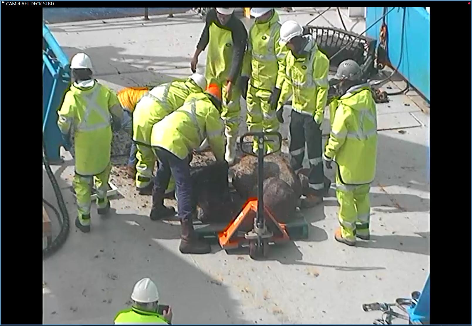 Antarctica or any sub-Antarctic island that has or had an ice sheet (e.g., Antarctica) or glacier (e.g., Heard Island), having been dropped by melting icebergs.
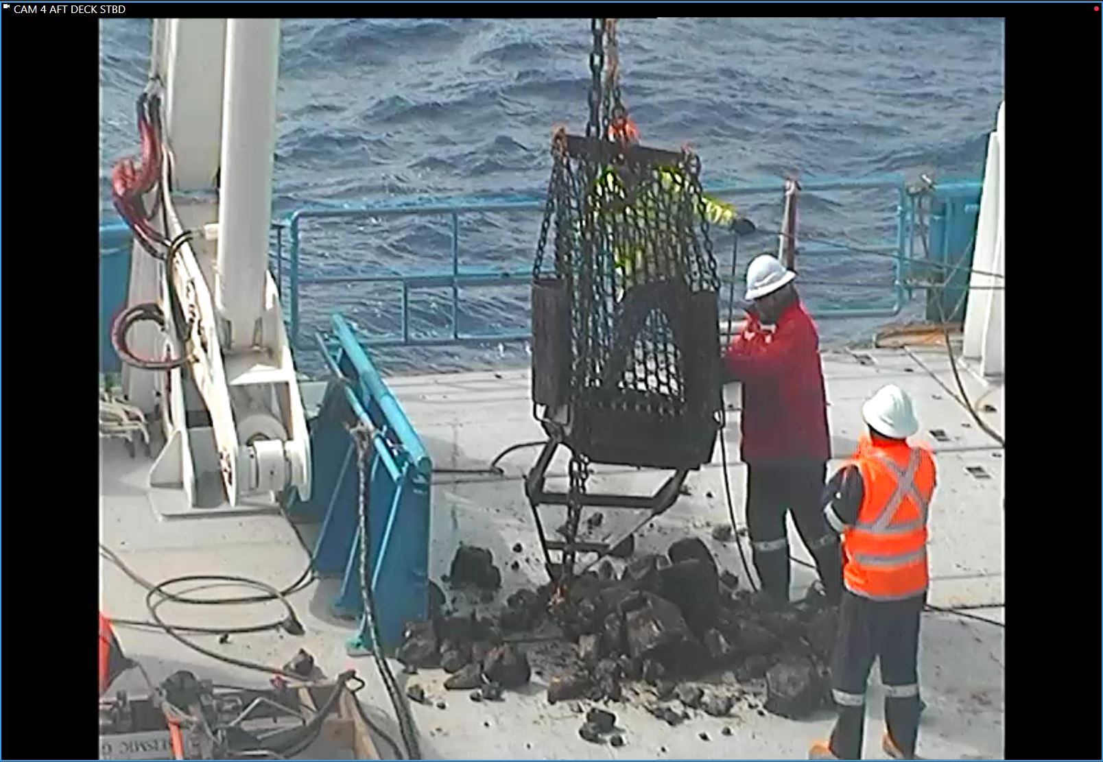
(image, right: The dredge team on the back deck assessing the dredge haul. Credit: CSIRO)
The dredge must be carefully monitored at all times, and winched in or out depending on seafloor topography and snags. Sometimes the dredge gets stuck while being dragged along the seafloor, acting as an anchor for the ship. More rarely, the dredge severs from the cable and remains permanently on the seafloor.
Whether empty or full, when the dredge reaches the surface the ship’s A-frame lifts the dredge over the back deck of the ship. If full, the dredge is turned upside-down to empty its payload of material.
As soon as the dredge itself is secured away from the dredged material lying on the back deck, the biologists examine it for biota and, if present, take samples. Then the rock dredging team carries all remaining material from the back deck into the ship’s dirty wet lab for cleaning, sorting, possibly sawing, describing, photographing, logging, bagging, and storing.
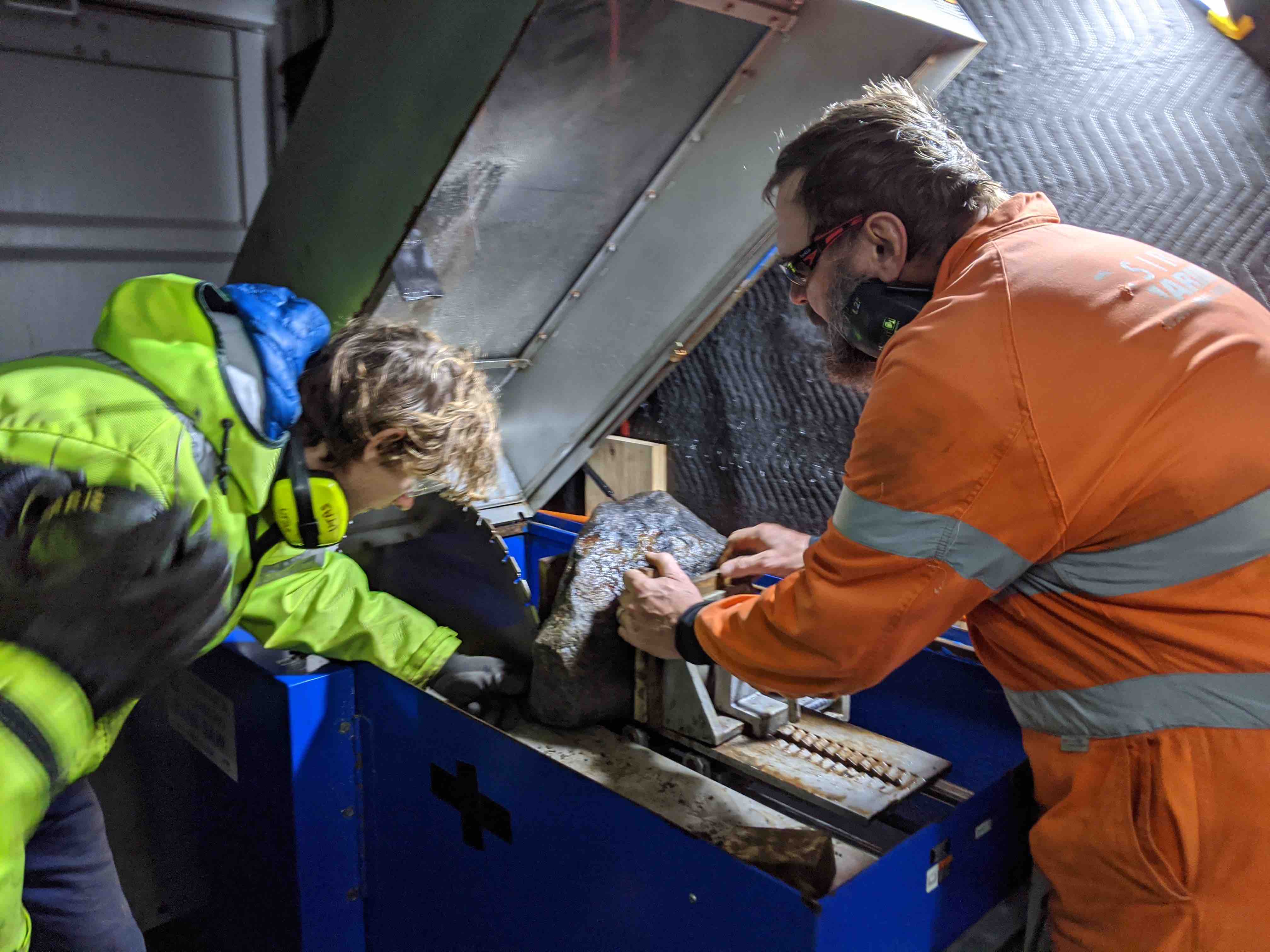 Many dredged rocks have ferromanganese crusts that obscure or completely hide the true nature of the rock. Therefore, to be able to describe the rock, it is typically sawn in half.
(Image, left: A dredged rock being sawn by the CSIRO’s Mark Lewis, with University of Tasmania undergraduate Jai McKay assisting. Credit: David Dieckfoss)
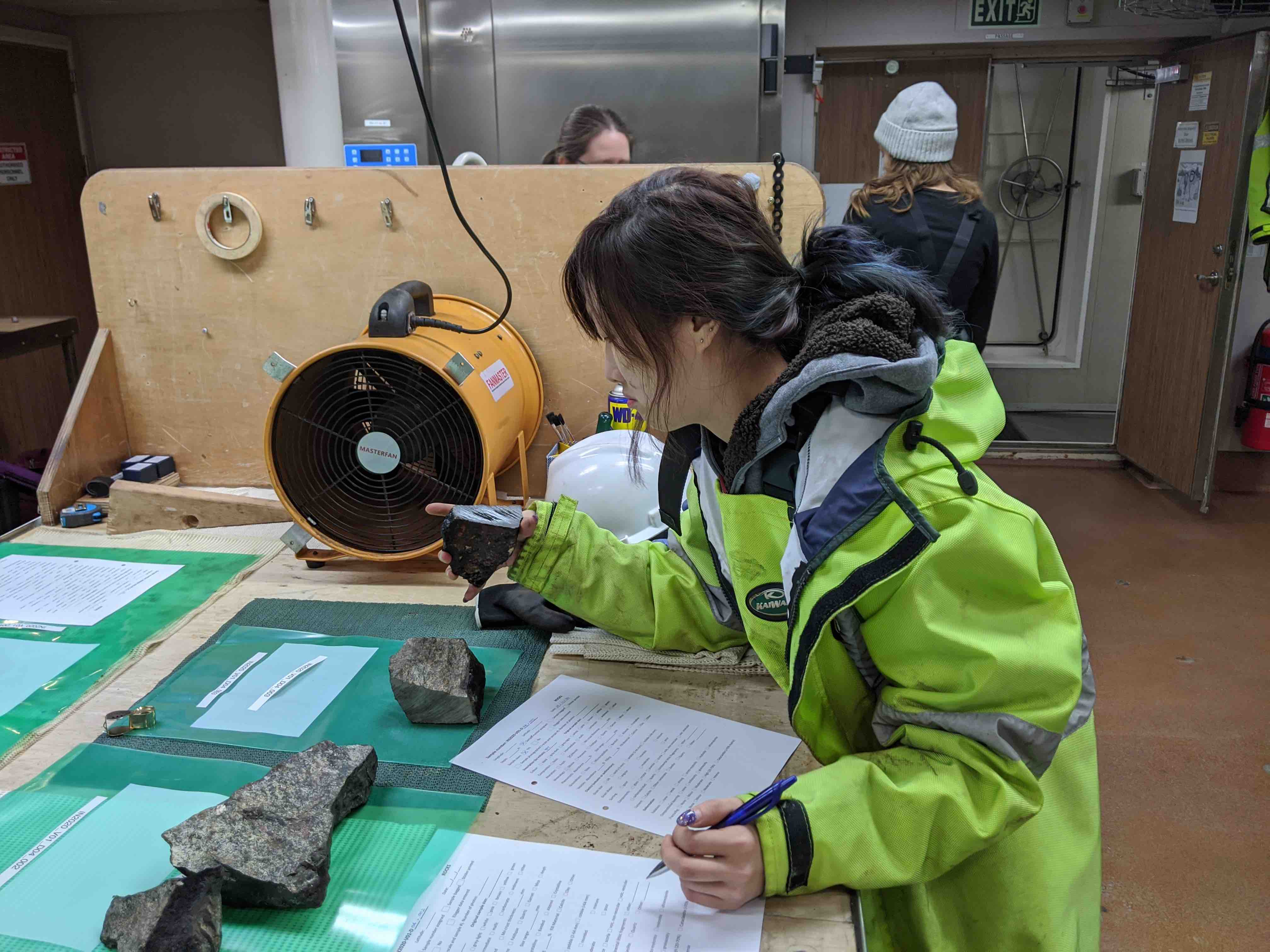
Rocks chosen to be retained are then described, photographed, logged, bagged, and stored by members of the rock dredge team. Rocks of no interest are returned to the sea.
Our dredged rocks will be transported to Hobart aboard RV Investigator. Once offloaded from the ship, they will be distributed to investigators at the University of Tasmania, Macquarie University, University of Cambridge, GEOMAR Helmholtz Centre for Ocean Research Kiel, University of Copenhagen, and Oregon State University for petrological, geochemical, and geochronological studies.
 On Friday 7 February we celebrated Hump Day, as in over-the-hump - the mid-point of the voyage. We sailed from Henderson, Western Australia, on 10 January, and have thus been at sea 28 days, and we’re due to return to Fremantle, Western Australia, on 6 March, 28 days from now.
(Image, right: A dredged rock being described by University of Tasmania Honours student Yun Fann Toh. Credit: David Dieckfoss)
By sheer coincidence, our proximate colleagues aboard RV Sonne also celebrated their Hump Day on 7 February, having departed Mauritius on 12 January, and scheduled to arrive in Cape Town on 3 March.
Our transits highlight the isolation of Heard Island relative to any major ports, with distances being: Cape Town: 4,777 km / 2,579 nautical miles (nm); Fremantle: 4,085 km / 2,206 nm; and Mauritius: 3,885 km/ 2,098 nm. And from RV Investigator’s and RV Sonne’s home ports of Hobart and Wilhelmshaven, Heard Island is 5,355 km / 2,891 nm and 13,293 km / 7,178 nm distant, respectively.
We’re both a long way from home, even at flank speed of 12 knots!
Australia’s marine research capacity achieved another milestone this week, namely the first operational deployment of the national high-resolution seismic reflection system available to the country’s entire research community and international collaborators. We acquired high-quality data with the system on two transects of William’s Ridge (Kerguelen Plateau) undertaken over four days (28, 29, and 30 January, and 2 February). We aspire to complete two more seismic transects across William’s Ridge before departing for Broken Ridge.
(Images, right: Seismic source (top) and seismic receiver, with ‘bird’ depth controller, (bottom) being deployed from the stern of RV Investigator. Credit: David Dieckfoss)
The balance of the past week was devoted to further mapping of William’s Ridge and successfully dredging rocks, with accompanying biota, from two sites on the feature. The new bathymetry is revealing major structures on the seafloor, and the seismic reflection data are illuminating sub-seafloor structure and stratigraphy. Dredged rocks will help define the nature and composition of William’s Ridge’s foundation.
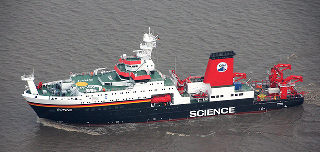
International scientific cooperation was on strong display over William’s Ridge this past week. The German RV Sonne (Pictured, below), led by Chief Scientist Dr Gabriele (Gabi) Uenzelmann-Neben of Germany’s Alfred Wegener Institute for Polar and Marine Research, arrived over William’s Ridge and began collecting seismic reflection data on 27 January.
Gabi and I worked closely together on our respective funding applications in Germany and Australia, including formally listing each other as collaborators on our proposals. Although our scientific objectives are entirely different, we agreed to share geophysical data in areas of mutual interest, and we have already exchanged preliminary multibeam/backscatter and seismic reflection data.
 When Gabi and I submitted our respective funding proposals, we had no idea if they’d be supported, nor did we know that if they were funded, when the research voyages might be scheduled. Thus it is entirely serendipitous that both RV Sonne and RV Investigator are working over the Kerguelen Plateau this January and February, the optimal weather window for marine research in the Furious Fifties. And it was fortuitous that we were within visible range briefly on the morning of 2 February.
The two vessels are the pride of the research fleets of our respective countries, were custom designed and delivered new in 2014, and are among the world’s most capable academic research ships. The table below includes some details of the two vessels as currently deployed.
Groundhog Day marked the conclusion of this week, and in some ways multiple starts of our second seismic transect were reminiscent of the eponymous film starring Bill Murray, Andie McDowell, and Chris Elliott. However we are acquiring new and stimulating data continuously, and the remarkable seascapes and weather change by the minute, so every day at sea is a new experience!
RV Investigator | RV Sonne | |
Length (m) | 93.9 | 118.4 |
Beam (m) | 18.5 | 20.6 |
Draft (m) | 6.2 | 6.6 |
Depth with gondola (m) | 9.5 | 9.8 |
Displacement (tons) | 6,082 | 8,554 |
Power (diesel) (kW) | 3 x 3,000 | 4 x 1,620 |
Propulsion (electric) (kW) | 2 x 2,600 | 2 x 2,350 |
Speed (kts) | 12 | 12 |
Ship’s crew | 20 | ≤32 |
Scientists + Support | ≤40 | ≤40 |
Range (nm) | 10,000 | 7,500 |
Endurance (days) | 60 | 50 |
Deep-water multibeam | EM122 | EM122 |
Shallow-water multibeam | EM710 | EM710 |
Sub-bottom Profiler | SBP120 | ParaSound |
Seismic Source (in3) | 420 | 840 |
Seismic Receiver (m) | 500 | 3,000 |
Our work on Rig Seismic Seamount concluded on 21 January, with three successful rock dredges undertaken. A variety of igneous and metamorphic rocks were recovered, the largest just barely fitting into the mouth of the dredge. Herculean attempts to split that boulder by courageous shipmates, armed with the biggest sledgehammer aboard, proved unsuccessful despite much encouragement from fellow sailors, so the entire boulder will return to Hobart aboard RV Investigator. Our two molecular biologists recovered biota from rocks in two of the three dredges.
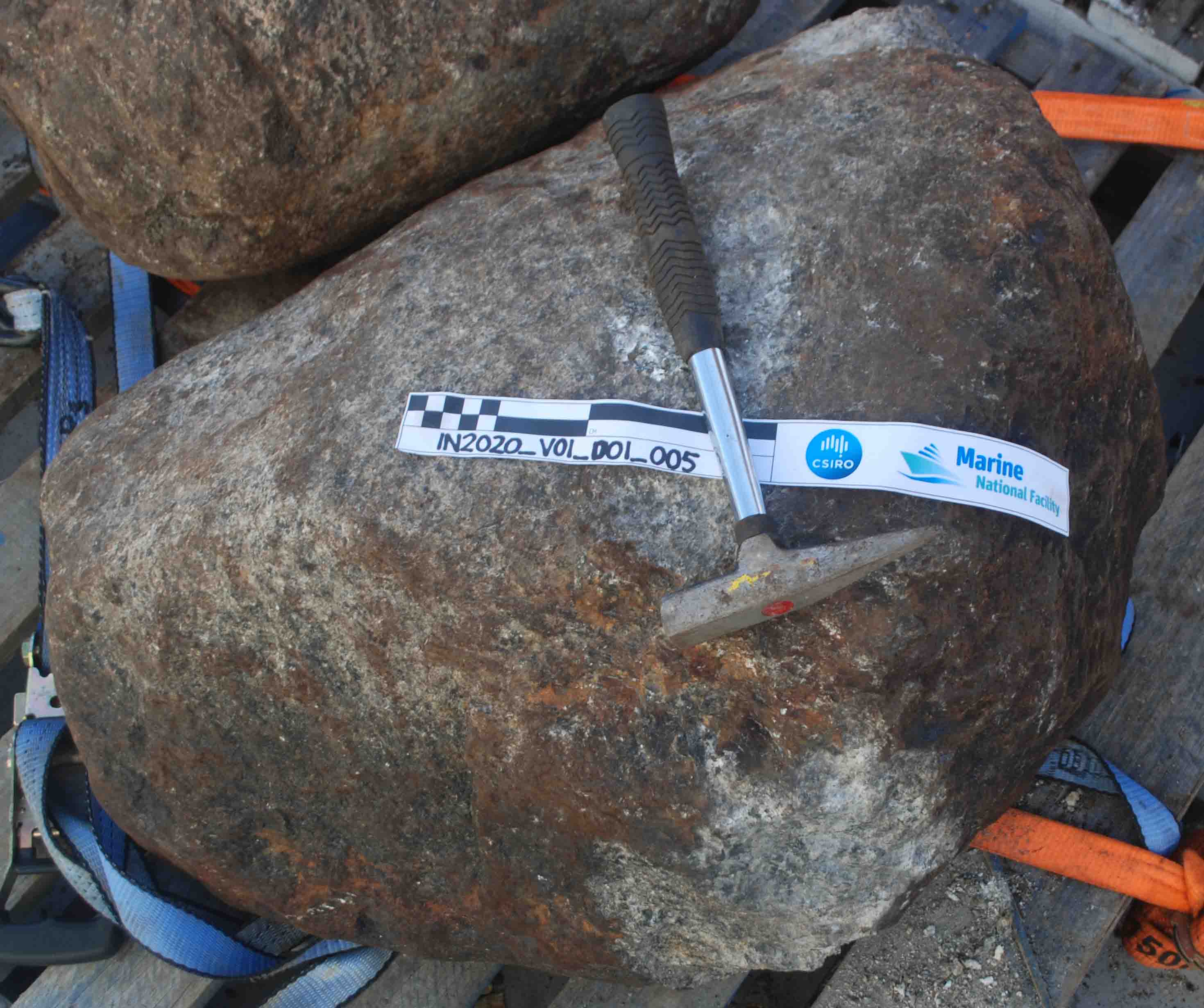 (Image, right: Boulder dredged from Rig Seismic Seamount. Credit: Haydn Titterton)
William’s Ridge, which extends southeast from the Central Kerguelen Plateau, constitutes phase two of our three-phase research program. We’ve been mapping the feature since 21 January, and this coming week, weather permitting, we plan to conduct seismic reflection profiling during the day and dredging during the night, with further mapping interspersed. Following modifications, we tested the seismic receiver again on 25 January, with encouraging results.
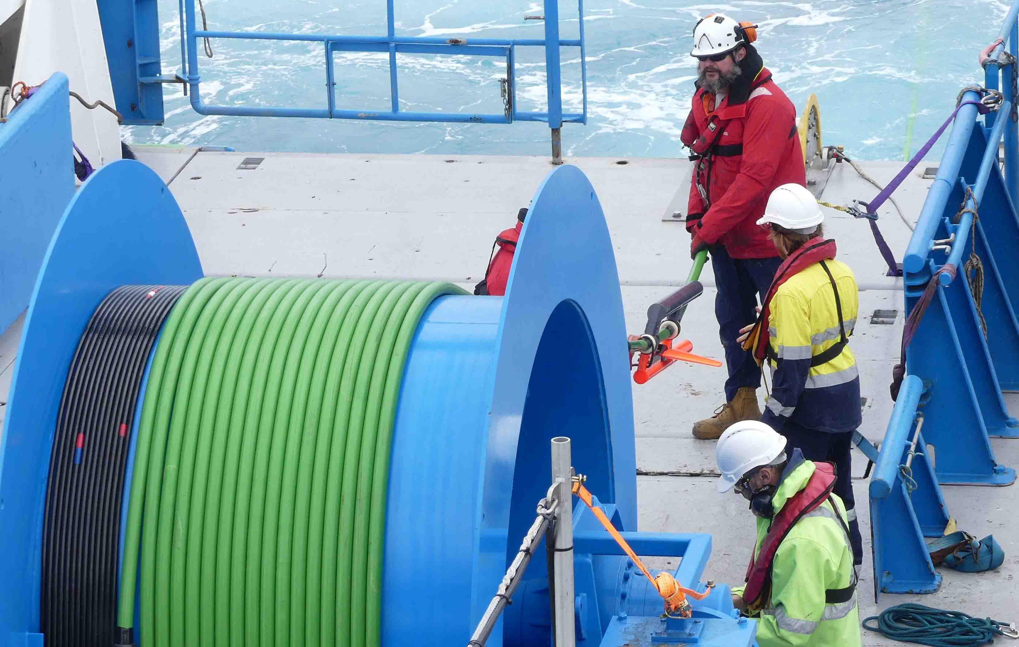
We deployed our second SOCCOM (Southern Ocean Carbon and Climate Observations and Modeling) float of the voyage on 21 January, adopted by year 7 and 8 students of the Seaside Middle School in Santa Cruz, California, USA. They named it The S.O.A.R.ing Eagle. To date, we’ve also deployed three floats for the international Argo global observation program.
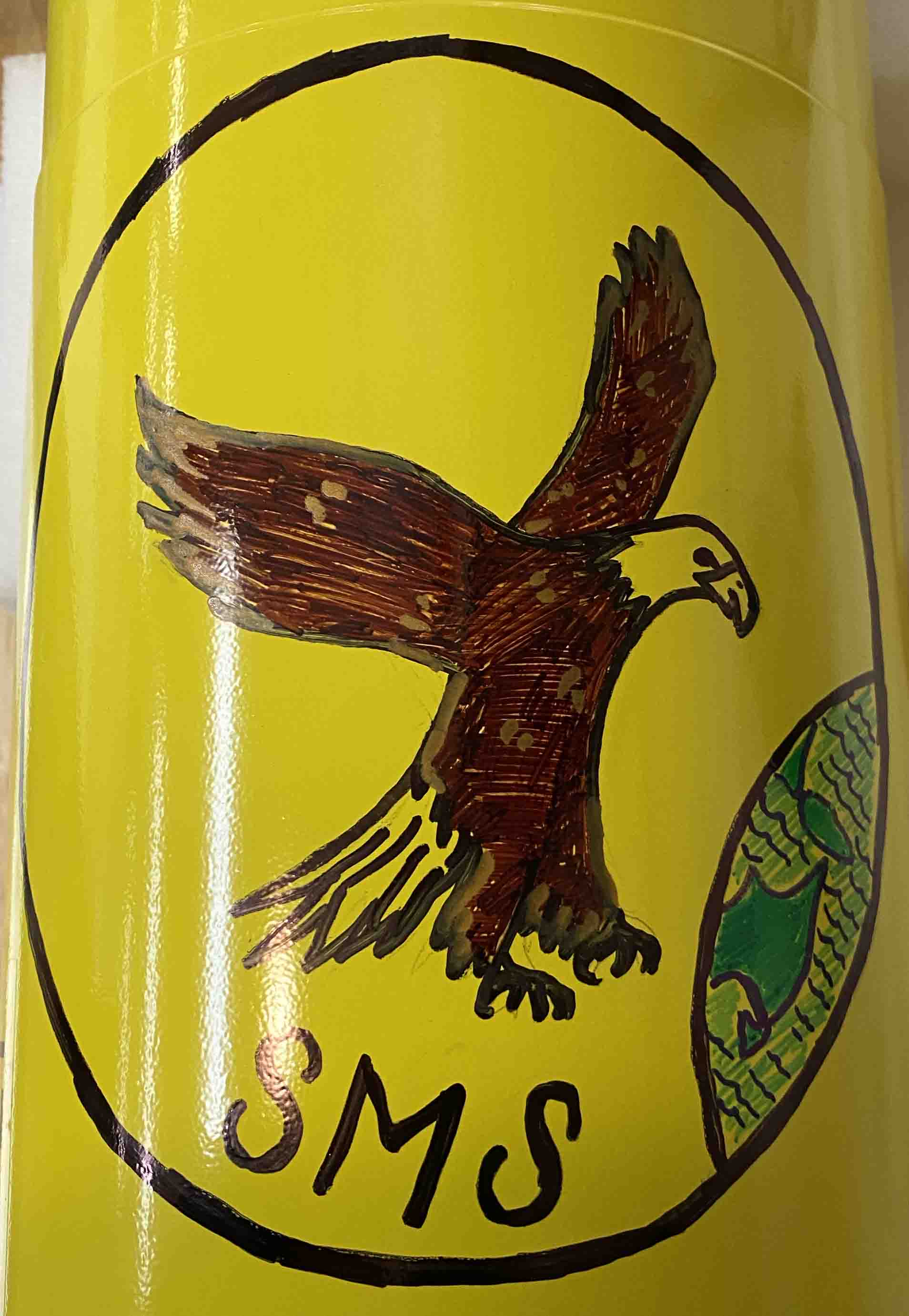 (Image, left: SOCCOM float The S.O.A.R.ing Eagle adorned by recent University of Tasmania graduate Eliza Kimlin. Credit: Mike Coffin)
Marine mammal observations reached a new peak on 25 January. We sighted four species of whales – blue, fin, pilot, and minke – and two species of dolphin –bottlenose and hourglass. And we observed a raft of Adélie penguins.
The demographics of our 56-strong ship’s complement have come to the fore with shipboard birthday celebrations. During our 56 days at sea, we are celebrating 12 birthdays. The mean age of the entire ship’s complement is 39 and the median age is 36 (range 19-64). Of the 22 members of the science party, the mean age is 31 and the median age is 26 (same range). The mean age of the 16 students aboard is 25 and the median age is 24 (range 19-32). With respect to gender, of the 22 scientists and students, 64% (14) are female and 36% (8) are male.
The Roaring Forties are in our wake - we’ve crossed the Southeast Indian Ridge and the Antarctic Convergence - and for the next several weeks we’ll be working in the Southern Ocean’s Furious Fifties. The long transit from Henderson, Western Australia, to the start of the first phase of our investigations on the Kerguelen Plateau concluded on 18 January. Into the second week of transit, we continued to test equipment and gain experience with shipboard systems and procedures. As on all transits, we’re continuously acquiring multibeam sonar, backscatter, sub-bottom profiler, gravity, and magnetics data. And we continue to launch robotic floats, three this week, for the international Argo program.
The day we sailed from Henderson we commenced a daily floating seminar program straddling the change in science watches at 1400; most members of the science party are standing 0200-1400 or 1400-0200 watches. At the seminars, typically two or three people speak for 15-20 minutes each, including questions and answers. The seminars provide an opportunity for us to introduce ourselves, our expertise, and our research plans for the voyage to one another. This is particularly important because this voyage is the first time the multidisciplinary team has been co-located, and many people haven’t met each other previously. Everyone on the ship is welcome both to attend and to give seminars.
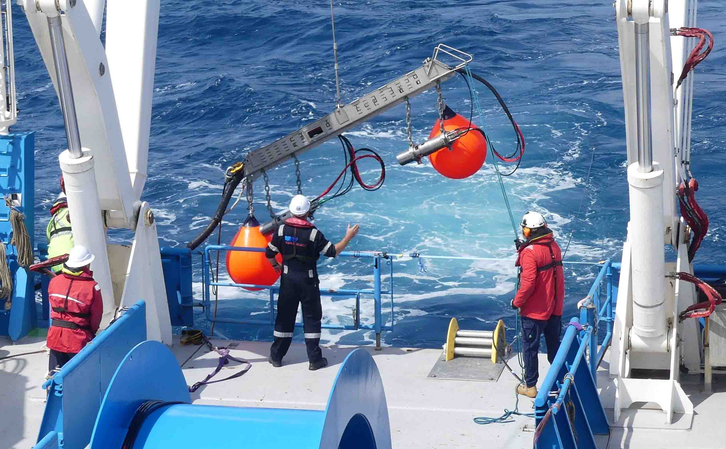
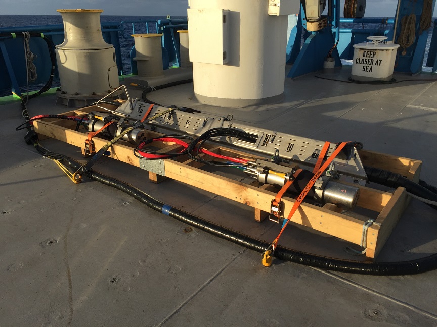
 A critical new system for our study is multichannel seismic reflection, which images sub-seafloor structure and stratigraphy. Australia’s Marine National Facility has recently acquired its own complete system, which has been funded by Geoscience Australia. This is a small-scale, high-resolution system used for research purposes. The seismic source and receiver are towed behind RV Investigator, the latter with an active length of 500 m. The data are monitored, quality-controlled, recorded, and initially processed in the ship’s Operations Room.
(Image, right: the seismic receiver (hydrophone streamer) on the large winch (right) with members of the IN2020_V01 science party. Credit: David Dieckfoss)
We conducted the first test of the complete system on 14 January en route south, and anticipate deploying it operationally in our William’s Ridge study area following seafloor mapping. Acquisition and operational deployment of the multichannel seismic reflection system represent a major milestone in capability for Australia’s marine geoscience community, which until this voyage has lacked such a national capability. The fundamental geophysical data gathered by this system will directly contribute to a potential new or revised Australian submission to the United Nations Commission on the Limits of the Continental Shelf (CLCS) for an increase in Australia’s marine jurisdiction around Heard and McDonald Islands.
(Image, below: The seismic source (air impulsive) in its storage box on the aft deck. Credit: Mike Coffin)
 Phase one of our three-phase research program is an estimated 2-day seafloor mapping and dredging campaign on Rig Seismic Seamount, situated in the Labuan Basin to the east of the Central Kerguelen Plateau. As of the evening of 19 January, we have completed mapping the feature and have just recovered our first of three planned dredges. Rig Seismic Seamount, rising from ~4500 m to ~2700 m, takes its name from Geoscience Australia’s former (1984-1998) research vessel Rig Seismic, aboard which scientists (including myself on my first expedition to the region) discovered the seamount in 1985 (RS47). On that voyage we acquired the first multichannel seismic reflection data from the Australian sector of the Kerguelen Plateau. In 1997, in preparation for Australia’s 2004 submission to the UN CLCS, Rig Seismic made two further voyages to this region, RS179 and RS180, on which I and IN2020_V01 Co-Chief Scientist George Bernardel, respectively, sailed.
Long summer days are conducive to our work program, morale, and aesthetics. Nights are only about 7.75 hours long. May the 19 January sunshine and gentle-to-moderate wind and wave conditions augur well for the upcoming several weeks of work in the Furious Fifties.
RV Investigator voyage IN2020_V01 – Development of William’s Ridge, Kerguelen Plateau: tectonics, hotspot magmatism, microcontinents, and Australia’s Extended Continental Shelf – departed Henderson, Western Australia, on Friday 10 January, bound for the Heard Island region, southern Indian Ocean, on a 57-day mission. The overarching objectives of the voyage are to:
 In addition, we will undertake a supplementary project to determine the timing of the most recent collapse of the West Antarctic Ice Sheet.
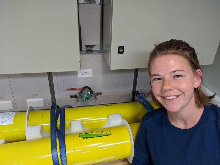
(Image, right: University of Tasmania undergraduate student Sylvie King and the SOCCOM float Mud Skipper that she adorned. Credit: David Dieckfoss)
I first had the idea for the primary investigation in 2015, and in the intervening five years, my colleagues and I have assembled a multi-disciplinary, international team of researchers and students, submitted multiple applications to various agencies and authorities for support and permissions, been granted shiptime and science funding, and obtained requisite environmental permits. Thus the voyage is the culmination of considerable effort and planning involving scores of people from around the world.
 The entire shipboard science and science support team first assembled 6-10 January for mobilisation of the voyage at BAE Henderson Port, Western Australia, where RV Investigator was berthed. Mobilisation activities were nonstop and intense for four days, mirroring the enthusiasm and anticipation of all voyage participants.
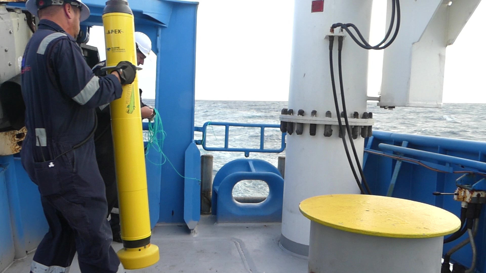
(Image, left,: SOCCOM float being deployed by RV Investigator crew members. Credit: David Dieckfoss)
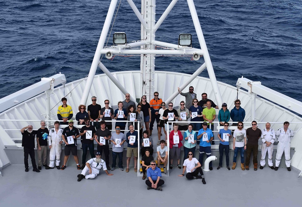
We number 56 souls on this voyage. That total includes 23 members of the science party, 11 science support staff, two medical specialists, and 20 ship’s crew. The 34-strong research team is a veritable United Nations, with 11 nationalities from four continents represented. This diversity reflects our efforts to assemble the best scientific team globally to achieve our research objectives as well as the boundless nature of the global ocean.
We embarked from Henderson at 0830 Friday 10 January and commenced the long transit to the Heard Island region. During the first three days of the transit, we’ve been acquiring multibeam, backscatter, sub-bottom profiler, water-column acoustic, magnetics, and gravity data continuously. We have also launched one robotic float, Mud Skipper (adopted and named by students from the College of Coastal Georgia, USA), for the Southern Ocean Carbon and Climate Observations and Modeling (SOCCOM) project (see photos). The sea state has been benevolent, facilitating development of our sea legs. We anticipate arriving at our first intensive study area, William’s Ridge, on 19 or 20 January, depending on weather conditions and equipment testing.
Institute for Marine and Antarctic Studies
Phone: +61 3 6226 6379
ABN: 30 764 374 782 CRICOS Provider Code: 00586B